You are here: Home > Network List > II - Global Seismograph Network (GSN - IRIS/IDA) Stations List
> Station WRAB Tennant Creek, NT, Australia > Earthquake Result Viewer
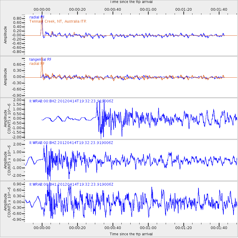
WRAB Tennant Creek, NT, Australia - Earthquake Result Viewer
*The percent match for this event was below the threshold and hence no stack was calculated.
| Earthquake location: |
Sunda Strait, Indonesia |
| Earthquake latitude/longitude: |
-6.8/105.5 |
| Earthquake time(UTC): |
2012/04/14 (105) 19:26:43 GMT |
| Earthquake Depth: |
63 km |
| Earthquake Magnitude: |
5.8 MW, 5.8 MW, 5.9 MB |
| Earthquake Catalog/Contributor: |
NEIC PDE/NEIC PDE-M |
|
| Network: |
II Global Seismograph Network (GSN - IRIS/IDA) |
| Station: |
WRAB Tennant Creek, NT, Australia |
| Lat/Lon: |
19.93 S/134.36 E |
| Elevation: |
366 m |
|
| Distance: |
30.9 deg |
| Az: |
117.779 deg |
| Baz: |
290.955 deg |
| Ray Param: |
$rayparam |
*The percent match for this event was below the threshold and hence was not used in the summary stack. |
|
| Radial Match: |
79.0688 % |
| Radial Bump: |
385 |
| Transverse Match: |
54.63126 % |
| Transverse Bump: |
400 |
| SOD ConfigId: |
558545 |
| Insert Time: |
2013-09-19 16:02:47.456 +0000 |
| GWidth: |
2.5 |
| Max Bumps: |
400 |
| Tol: |
0.001 |
|
Signal To Noise
| Channel | StoN | STA | LTA |
| II:WRAB:00:BHZ:20120414T19:32:23.919006Z | 3.3004127 | 1.0991457E-6 | 3.330328E-7 |
| II:WRAB:00:BH1:20120414T19:32:23.919006Z | 2.3815317 | 4.072765E-7 | 1.7101452E-7 |
| II:WRAB:00:BH2:20120414T19:32:23.919006Z | 6.7825236 | 9.3609435E-7 | 1.3801565E-7 |
| Arrivals |
| Ps | |
| PpPs | |
| PsPs/PpSs | |


