You are here: Home > Network List > IU - Global Seismograph Network (GSN - IRIS/USGS) Stations List
> Station HNR Honiara, Solomon Islands > Earthquake Result Viewer
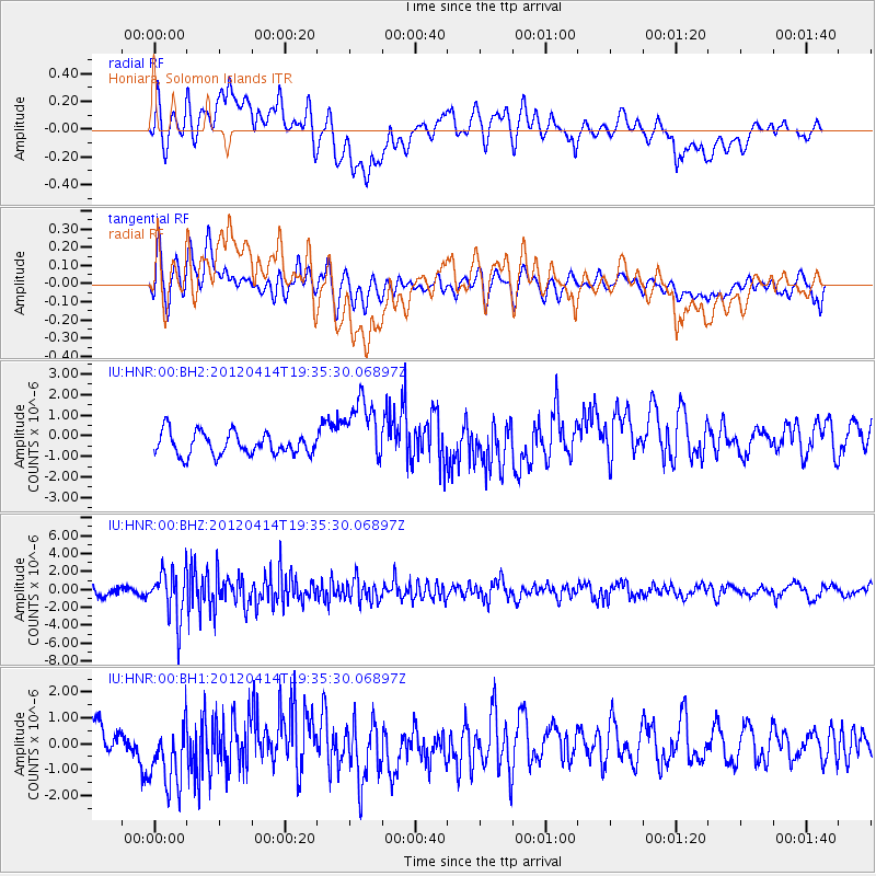
HNR Honiara, Solomon Islands - Earthquake Result Viewer
*The percent match for this event was below the threshold and hence no stack was calculated.
| Earthquake location: |
Sunda Strait, Indonesia |
| Earthquake latitude/longitude: |
-6.8/105.5 |
| Earthquake time(UTC): |
2012/04/14 (105) 19:26:43 GMT |
| Earthquake Depth: |
63 km |
| Earthquake Magnitude: |
5.8 MW, 5.8 MW, 5.9 MB |
| Earthquake Catalog/Contributor: |
NEIC PDE/NEIC PDE-M |
|
| Network: |
IU Global Seismograph Network (GSN - IRIS/USGS) |
| Station: |
HNR Honiara, Solomon Islands |
| Lat/Lon: |
9.44 S/159.95 E |
| Elevation: |
100 m |
|
| Distance: |
54.0 deg |
| Az: |
96.696 deg |
| Baz: |
268.424 deg |
| Ray Param: |
$rayparam |
*The percent match for this event was below the threshold and hence was not used in the summary stack. |
|
| Radial Match: |
46.224384 % |
| Radial Bump: |
400 |
| Transverse Match: |
56.838905 % |
| Transverse Bump: |
400 |
| SOD ConfigId: |
558545 |
| Insert Time: |
2013-09-19 16:02:58.238 +0000 |
| GWidth: |
2.5 |
| Max Bumps: |
400 |
| Tol: |
0.001 |
|
Signal To Noise
| Channel | StoN | STA | LTA |
| IU:HNR:00:BHZ:20120414T19:35:30.06897Z | 4.3656554 | 2.6574821E-6 | 6.087247E-7 |
| IU:HNR:00:BH1:20120414T19:35:30.06897Z | 2.5372229 | 1.4589247E-6 | 5.7500847E-7 |
| IU:HNR:00:BH2:20120414T19:35:30.06897Z | 3.0275996 | 1.6312414E-6 | 5.3879035E-7 |
| Arrivals |
| Ps | |
| PpPs | |
| PsPs/PpSs | |


