You are here: Home > Network List > CN - Canadian National Seismograph Network Stations List
> Station PMB Pemberton, British Columbia, Canada > Earthquake Result Viewer
PMB Pemberton, British Columbia, Canada - Earthquake Result Viewer

| Earthquake location: |
Kermadec Islands Region |
| Earthquake latitude/longitude: |
-28.7/-177.6 |
| Earthquake time(UTC): |
1997/09/20 (263) 16:11:32 GMT |
| Earthquake Depth: |
30 km |
| Earthquake Magnitude: |
6.1 MB, 7.0 MS, 7.2 UNKNOWN, 6.7 ME |
| Earthquake Catalog/Contributor: |
WHDF/NEIC |
|
| Network: |
CN Canadian National Seismograph Network |
| Station: |
PMB Pemberton, British Columbia, Canada |
| Lat/Lon: |
50.52 N/123.08 W |
| Elevation: |
400 m |
|
| Distance: |
92.4 deg |
| Az: |
31.364 deg |
| Baz: |
225.756 deg |
| Ray Param: |
0.04145287 |
| Estimated Moho Depth: |
15.25 km |
| Estimated Crust Vp/Vs: |
1.62 |
| Assumed Crust Vp: |
6.566 km/s |
| Estimated Crust Vs: |
4.059 km/s |
| Estimated Crust Poisson's Ratio: |
0.19 |
|
| Radial Match: |
90.067535 % |
| Radial Bump: |
400 |
| Transverse Match: |
85.144554 % |
| Transverse Bump: |
400 |
| SOD ConfigId: |
4480 |
| Insert Time: |
2010-02-27 06:51:52.515 +0000 |
| GWidth: |
2.5 |
| Max Bumps: |
400 |
| Tol: |
0.001 |
|
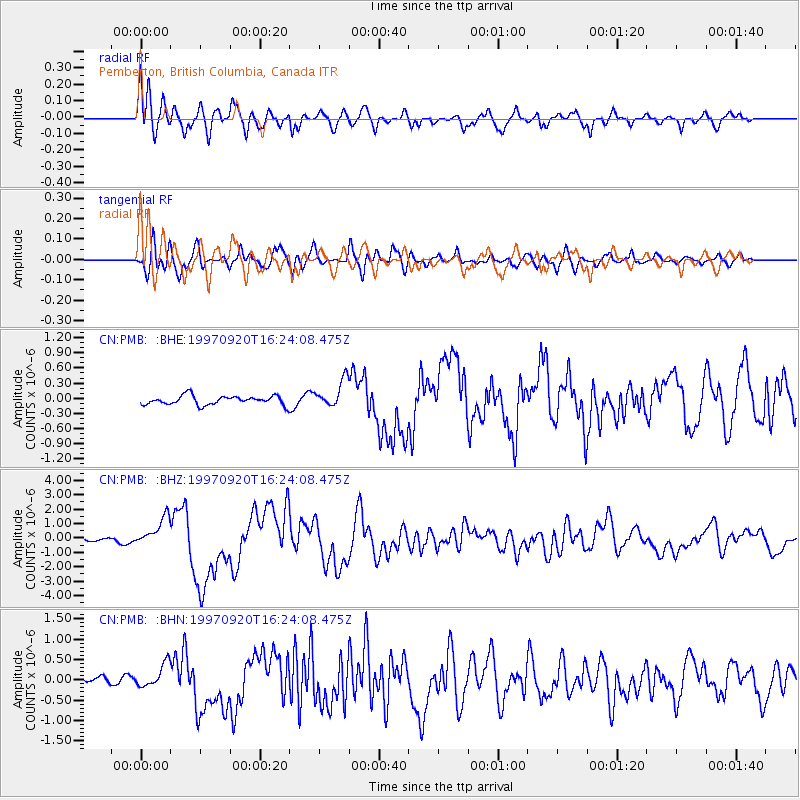
Signal To Noise
| Channel | StoN | STA | LTA |
| CN:PMB: :BHZ:19970920T16:24:08.475Z | 8.352019 | 1.0145955E-6 | 1.2147906E-7 |
| CN:PMB: :BHN:19970920T16:24:08.475Z | 2.5538669 | 2.9032964E-7 | 1.1368236E-7 |
| CN:PMB: :BHE:19970920T16:24:08.475Z | 3.017104 | 2.688144E-7 | 8.909684E-8 |
| Arrivals |
| Ps | 1.5 SECOND |
| PpPs | 5.9 SECOND |
| PsPs/PpSs | 7.4 SECOND |


