You are here: Home > Network List > US - United States National Seismic Network Stations List
> Station MSO Missoula, Montana, USA > Earthquake Result Viewer
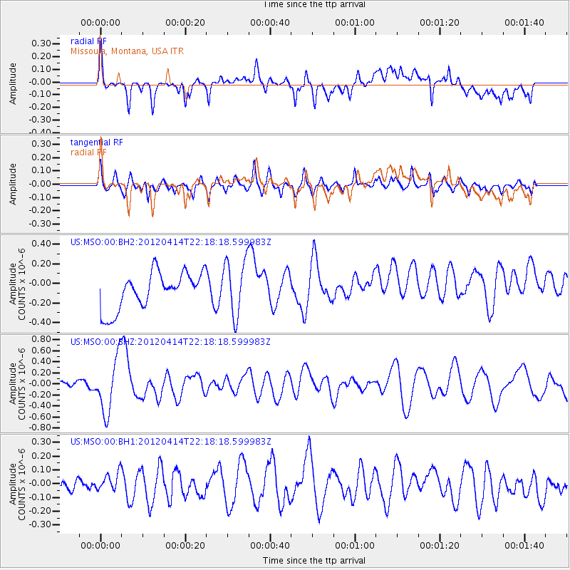
MSO Missoula, Montana, USA - Earthquake Result Viewer
*The percent match for this event was below the threshold and hence no stack was calculated.
| Earthquake location: |
Vanuatu Islands |
| Earthquake latitude/longitude: |
-19.0/168.7 |
| Earthquake time(UTC): |
2012/04/14 (105) 22:05:26 GMT |
| Earthquake Depth: |
11 km |
| Earthquake Magnitude: |
6.3 MW, 6.0 MB, 6.2 MW, 6.2 MS |
| Earthquake Catalog/Contributor: |
NEIC PDE/NEIC PDE-M |
|
| Network: |
US United States National Seismic Network |
| Station: |
MSO Missoula, Montana, USA |
| Lat/Lon: |
46.83 N/113.94 W |
| Elevation: |
1264 m |
|
| Distance: |
95.3 deg |
| Az: |
42.279 deg |
| Baz: |
248.005 deg |
| Ray Param: |
$rayparam |
*The percent match for this event was below the threshold and hence was not used in the summary stack. |
|
| Radial Match: |
56.12772 % |
| Radial Bump: |
400 |
| Transverse Match: |
45.540928 % |
| Transverse Bump: |
400 |
| SOD ConfigId: |
558545 |
| Insert Time: |
2013-09-19 16:08:21.521 +0000 |
| GWidth: |
2.5 |
| Max Bumps: |
400 |
| Tol: |
0.001 |
|
Signal To Noise
| Channel | StoN | STA | LTA |
| US:MSO:00:BHZ:20120414T22:18:18.599983Z | 4.276315 | 5.1548966E-7 | 1.205453E-7 |
| US:MSO:00:BH1:20120414T22:18:18.599983Z | 0.9667419 | 7.161393E-8 | 7.407761E-8 |
| US:MSO:00:BH2:20120414T22:18:18.599983Z | 1.564377 | 2.939718E-7 | 1.8791621E-7 |
| Arrivals |
| Ps | |
| PpPs | |
| PsPs/PpSs | |


