You are here: Home > Network List > IU - Global Seismograph Network (GSN - IRIS/USGS) Stations List
> Station HNR Honiara, Solomon Islands > Earthquake Result Viewer
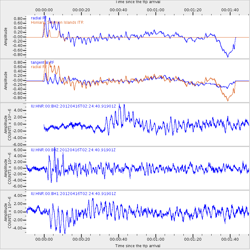
HNR Honiara, Solomon Islands - Earthquake Result Viewer
*The percent match for this event was below the threshold and hence no stack was calculated.
| Earthquake location: |
Sulawesi, Indonesia |
| Earthquake latitude/longitude: |
-2.6/121.9 |
| Earthquake time(UTC): |
2012/04/16 (107) 02:17:50 GMT |
| Earthquake Depth: |
13 km |
| Earthquake Magnitude: |
5.6 MB, 5.5 MS, 5.8 MW, 5.7 MW |
| Earthquake Catalog/Contributor: |
WHDF/NEIC |
|
| Network: |
IU Global Seismograph Network (GSN - IRIS/USGS) |
| Station: |
HNR Honiara, Solomon Islands |
| Lat/Lon: |
9.44 S/159.95 E |
| Elevation: |
100 m |
|
| Distance: |
38.5 deg |
| Az: |
101.806 deg |
| Baz: |
277.666 deg |
| Ray Param: |
$rayparam |
*The percent match for this event was below the threshold and hence was not used in the summary stack. |
|
| Radial Match: |
57.54596 % |
| Radial Bump: |
400 |
| Transverse Match: |
60.53833 % |
| Transverse Bump: |
400 |
| SOD ConfigId: |
558545 |
| Insert Time: |
2013-09-19 16:11:37.469 +0000 |
| GWidth: |
2.5 |
| Max Bumps: |
400 |
| Tol: |
0.001 |
|
Signal To Noise
| Channel | StoN | STA | LTA |
| IU:HNR:00:BHZ:20120416T02:24:40.91901Z | 4.0082808 | 2.0131738E-6 | 5.0225367E-7 |
| IU:HNR:00:BH1:20120416T02:24:40.91901Z | 3.1522222 | 1.7688976E-6 | 5.6115897E-7 |
| IU:HNR:00:BH2:20120416T02:24:40.91901Z | 2.5240078 | 1.3221146E-6 | 5.238156E-7 |
| Arrivals |
| Ps | |
| PpPs | |
| PsPs/PpSs | |


