You are here: Home > Network List > IU - Global Seismograph Network (GSN - IRIS/USGS) Stations List
> Station RSSD Black Hills, South Dakota, USA > Earthquake Result Viewer
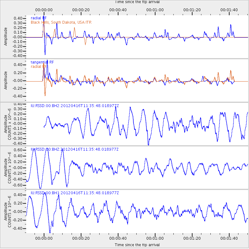
RSSD Black Hills, South Dakota, USA - Earthquake Result Viewer
*The percent match for this event was below the threshold and hence no stack was calculated.
| Earthquake location: |
Southern Greece |
| Earthquake latitude/longitude: |
36.6/21.5 |
| Earthquake time(UTC): |
2012/04/16 (107) 11:23:43 GMT |
| Earthquake Depth: |
29 km |
| Earthquake Magnitude: |
5.8 MW, 5.7 MW |
| Earthquake Catalog/Contributor: |
NEIC PDE/NEIC PDE-M |
|
| Network: |
IU Global Seismograph Network (GSN - IRIS/USGS) |
| Station: |
RSSD Black Hills, South Dakota, USA |
| Lat/Lon: |
44.12 N/104.04 W |
| Elevation: |
2090 m |
|
| Distance: |
85.7 deg |
| Az: |
323.99 deg |
| Baz: |
41.046 deg |
| Ray Param: |
$rayparam |
*The percent match for this event was below the threshold and hence was not used in the summary stack. |
|
| Radial Match: |
76.8088 % |
| Radial Bump: |
400 |
| Transverse Match: |
83.25663 % |
| Transverse Bump: |
382 |
| SOD ConfigId: |
558545 |
| Insert Time: |
2013-09-19 16:14:35.754 +0000 |
| GWidth: |
2.5 |
| Max Bumps: |
400 |
| Tol: |
0.001 |
|
Signal To Noise
| Channel | StoN | STA | LTA |
| IU:RSSD:00:BHZ:20120416T11:35:48.018977Z | 1.6336967 | 4.362686E-7 | 2.6704382E-7 |
| IU:RSSD:00:BH1:20120416T11:35:48.018977Z | 1.6957089 | 3.4241776E-7 | 2.0193194E-7 |
| IU:RSSD:00:BH2:20120416T11:35:48.018977Z | 0.63745916 | 7.473049E-8 | 1.172318E-7 |
| Arrivals |
| Ps | |
| PpPs | |
| PsPs/PpSs | |


