You are here: Home > Network List > US - United States National Seismic Network Stations List
> Station EGMT Eagleton, Montana, USA > Earthquake Result Viewer
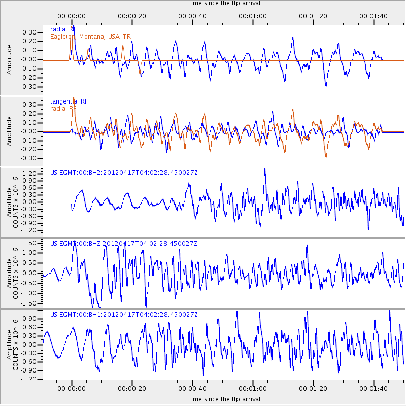
EGMT Eagleton, Montana, USA - Earthquake Result Viewer
*The percent match for this event was below the threshold and hence no stack was calculated.
| Earthquake location: |
Near Coast Of Central Chile |
| Earthquake latitude/longitude: |
-32.6/-71.4 |
| Earthquake time(UTC): |
2012/04/17 (108) 03:50:15 GMT |
| Earthquake Depth: |
29 km |
| Earthquake Magnitude: |
6.7 MW, 6.2 MB, 6.2 MS, 6.7 MW |
| Earthquake Catalog/Contributor: |
NEIC PDE/NEIC PDE-M |
|
| Network: |
US United States National Seismic Network |
| Station: |
EGMT Eagleton, Montana, USA |
| Lat/Lon: |
48.02 N/109.75 W |
| Elevation: |
1055 m |
|
| Distance: |
87.3 deg |
| Az: |
335.334 deg |
| Baz: |
148.358 deg |
| Ray Param: |
$rayparam |
*The percent match for this event was below the threshold and hence was not used in the summary stack. |
|
| Radial Match: |
59.15901 % |
| Radial Bump: |
400 |
| Transverse Match: |
65.83849 % |
| Transverse Bump: |
400 |
| SOD ConfigId: |
558545 |
| Insert Time: |
2013-09-19 16:20:02.977 +0000 |
| GWidth: |
2.5 |
| Max Bumps: |
400 |
| Tol: |
0.001 |
|
Signal To Noise
| Channel | StoN | STA | LTA |
| US:EGMT:00:BHZ:20120417T04:02:28.450027Z | 7.0016484 | 7.643821E-7 | 1.0917174E-7 |
| US:EGMT:00:BH1:20120417T04:02:28.450027Z | 0.9614499 | 3.681712E-7 | 3.829333E-7 |
| US:EGMT:00:BH2:20120417T04:02:28.450027Z | 0.6712861 | 1.525691E-7 | 2.272788E-7 |
| Arrivals |
| Ps | |
| PpPs | |
| PsPs/PpSs | |


