You are here: Home > Network List > US - United States National Seismic Network Stations List
> Station MNTX Cornudas Mountains, Texas, USA > Earthquake Result Viewer
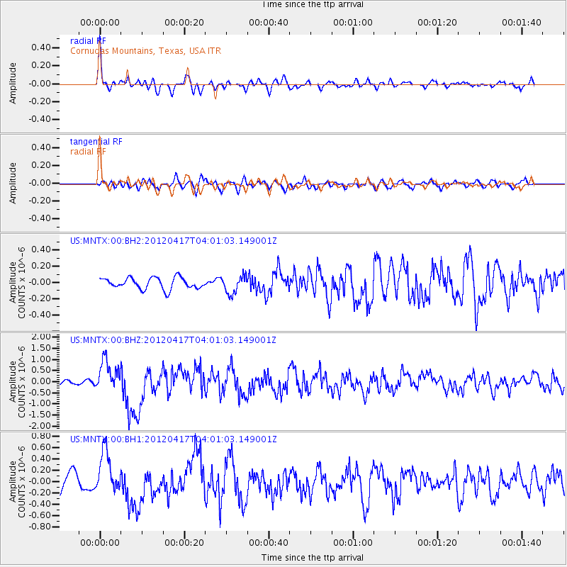
MNTX Cornudas Mountains, Texas, USA - Earthquake Result Viewer
*The percent match for this event was below the threshold and hence no stack was calculated.
| Earthquake location: |
Near Coast Of Central Chile |
| Earthquake latitude/longitude: |
-32.6/-71.4 |
| Earthquake time(UTC): |
2012/04/17 (108) 03:50:15 GMT |
| Earthquake Depth: |
29 km |
| Earthquake Magnitude: |
6.7 MW, 6.2 MB, 6.2 MS, 6.7 MW |
| Earthquake Catalog/Contributor: |
NEIC PDE/NEIC PDE-M |
|
| Network: |
US United States National Seismic Network |
| Station: |
MNTX Cornudas Mountains, Texas, USA |
| Lat/Lon: |
31.70 N/105.38 W |
| Elevation: |
404 m |
|
| Distance: |
71.6 deg |
| Az: |
329.831 deg |
| Baz: |
150.164 deg |
| Ray Param: |
$rayparam |
*The percent match for this event was below the threshold and hence was not used in the summary stack. |
|
| Radial Match: |
76.957214 % |
| Radial Bump: |
400 |
| Transverse Match: |
75.8296 % |
| Transverse Bump: |
400 |
| SOD ConfigId: |
558545 |
| Insert Time: |
2013-09-19 16:20:52.453 +0000 |
| GWidth: |
2.5 |
| Max Bumps: |
400 |
| Tol: |
0.001 |
|
Signal To Noise
| Channel | StoN | STA | LTA |
| US:MNTX:00:BHZ:20120417T04:01:03.149001Z | 6.5749936 | 7.124909E-7 | 1.0836374E-7 |
| US:MNTX:00:BH1:20120417T04:01:03.149001Z | 2.6026888 | 3.7533817E-7 | 1.442117E-7 |
| US:MNTX:00:BH2:20120417T04:01:03.149001Z | 1.583517 | 1.103962E-7 | 6.971583E-8 |
| Arrivals |
| Ps | |
| PpPs | |
| PsPs/PpSs | |


