You are here: Home > Network List > CN - Canadian National Seismograph Network Stations List
> Station PMB Pemberton, British Columbia, Canada > Earthquake Result Viewer
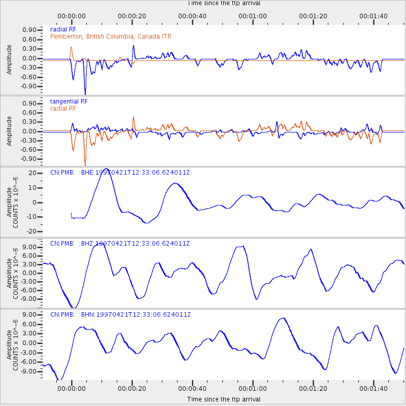
PMB Pemberton, British Columbia, Canada - Earthquake Result Viewer
*The percent match for this event was below the threshold and hence no stack was calculated.
| Earthquake location: |
Vanuatu Islands |
| Earthquake latitude/longitude: |
-13.6/166.8 |
| Earthquake time(UTC): |
1997/04/21 (111) 12:20:50 GMT |
| Earthquake Depth: |
33 km |
| Earthquake Magnitude: |
5.7 MB |
| Earthquake Catalog/Contributor: |
WHDF/NEIC |
|
| Network: |
CN Canadian National Seismograph Network |
| Station: |
PMB Pemberton, British Columbia, Canada |
| Lat/Lon: |
50.52 N/123.08 W |
| Elevation: |
400 m |
|
| Distance: |
88.2 deg |
| Az: |
36.907 deg |
| Baz: |
246.157 deg |
| Ray Param: |
$rayparam |
*The percent match for this event was below the threshold and hence was not used in the summary stack. |
|
| Radial Match: |
75.68146 % |
| Radial Bump: |
371 |
| Transverse Match: |
63.592037 % |
| Transverse Bump: |
400 |
| SOD ConfigId: |
4480 |
| Insert Time: |
2010-02-27 06:52:51.524 +0000 |
| GWidth: |
2.5 |
| Max Bumps: |
400 |
| Tol: |
0.001 |
|
Signal To Noise
| Channel | StoN | STA | LTA |
| CN:PMB: :BHZ:19970421T12:33:06.624011Z | 1.8206956 | 9.902279E-6 | 5.438734E-6 |
| CN:PMB: :BHN:19970421T12:33:06.624011Z | 0.4091308 | 4.3325513E-6 | 1.0589648E-5 |
| CN:PMB: :BHE:19970421T12:33:06.624011Z | 0.83640516 | 9.959528E-6 | 1.190754E-5 |
| Arrivals |
| Ps | |
| PpPs | |
| PsPs/PpSs | |


