You are here: Home > Network List > CN - Canadian National Seismograph Network Stations List
> Station PMB Pemberton, British Columbia, Canada > Earthquake Result Viewer
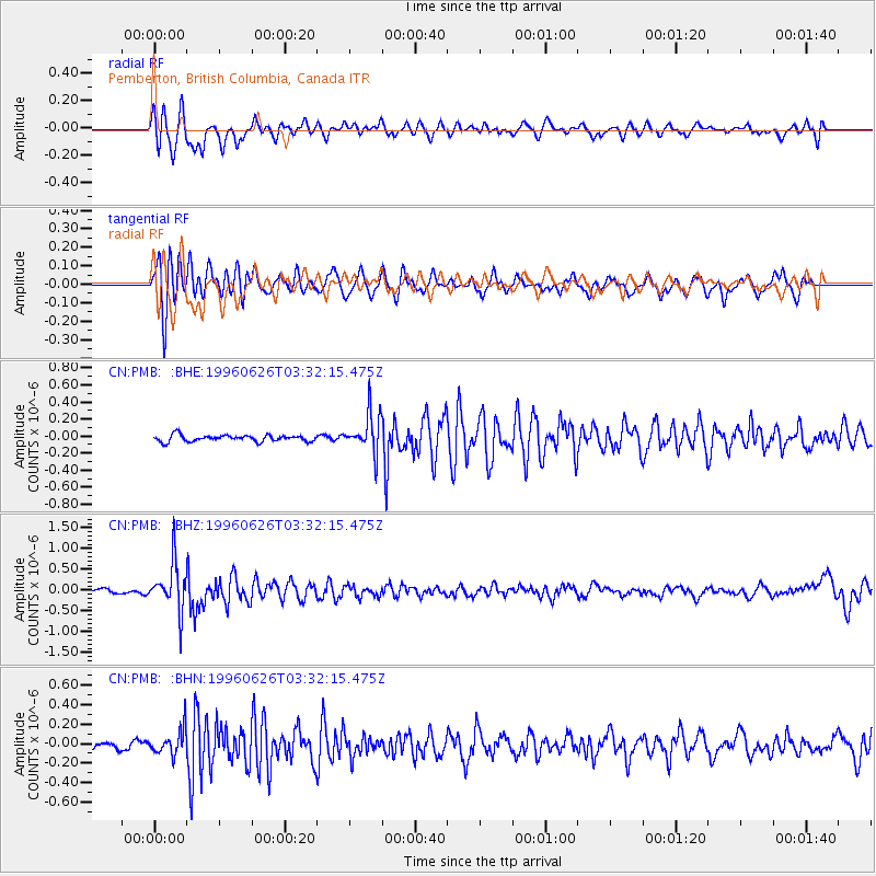
PMB Pemberton, British Columbia, Canada - Earthquake Result Viewer
*The percent match for this event was below the threshold and hence no stack was calculated.
| Earthquake location: |
Bonin Islands, Japan Region |
| Earthquake latitude/longitude: |
27.7/139.7 |
| Earthquake time(UTC): |
1996/06/26 (178) 03:22:03 GMT |
| Earthquake Depth: |
469 km |
| Earthquake Magnitude: |
5.5 MB, 6.3 UNKNOWN, 5.4 MB |
| Earthquake Catalog/Contributor: |
WHDF/NEIC |
|
| Network: |
CN Canadian National Seismograph Network |
| Station: |
PMB Pemberton, British Columbia, Canada |
| Lat/Lon: |
50.52 N/123.08 W |
| Elevation: |
400 m |
|
| Distance: |
73.4 deg |
| Az: |
41.367 deg |
| Baz: |
293.405 deg |
| Ray Param: |
$rayparam |
*The percent match for this event was below the threshold and hence was not used in the summary stack. |
|
| Radial Match: |
55.412663 % |
| Radial Bump: |
369 |
| Transverse Match: |
71.296135 % |
| Transverse Bump: |
400 |
| SOD ConfigId: |
4480 |
| Insert Time: |
2010-02-27 06:53:17.225 +0000 |
| GWidth: |
2.5 |
| Max Bumps: |
400 |
| Tol: |
0.001 |
|
Signal To Noise
| Channel | StoN | STA | LTA |
| CN:PMB: :BHZ:19960626T03:32:15.475Z | 9.000388 | 5.70706E-7 | 6.340905E-8 |
| CN:PMB: :BHN:19960626T03:32:15.475Z | 2.357702 | 1.288433E-7 | 5.464783E-8 |
| CN:PMB: :BHE:19960626T03:32:15.475Z | 6.0289807 | 2.2675728E-7 | 3.7611212E-8 |
| Arrivals |
| Ps | |
| PpPs | |
| PsPs/PpSs | |


