You are here: Home > Network List > US - United States National Seismic Network Stations List
> Station EGMT Eagleton, Montana, USA > Earthquake Result Viewer
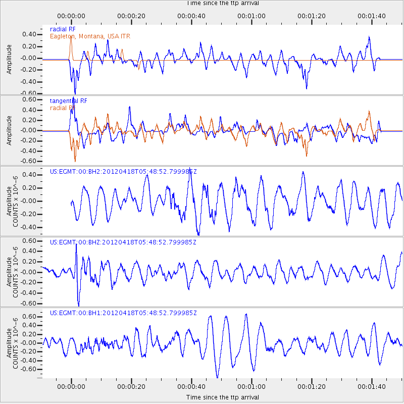
EGMT Eagleton, Montana, USA - Earthquake Result Viewer
*The percent match for this event was below the threshold and hence no stack was calculated.
| Earthquake location: |
Bonin Islands, Japan Region |
| Earthquake latitude/longitude: |
28.7/138.8 |
| Earthquake time(UTC): |
2012/04/18 (109) 05:37:55 GMT |
| Earthquake Depth: |
494 km |
| Earthquake Magnitude: |
5.5 MW |
| Earthquake Catalog/Contributor: |
NEIC PDE/NEIC PDE-M |
|
| Network: |
US United States National Seismic Network |
| Station: |
EGMT Eagleton, Montana, USA |
| Lat/Lon: |
48.02 N/109.75 W |
| Elevation: |
1055 m |
|
| Distance: |
82.1 deg |
| Az: |
39.105 deg |
| Baz: |
304.36 deg |
| Ray Param: |
$rayparam |
*The percent match for this event was below the threshold and hence was not used in the summary stack. |
|
| Radial Match: |
50.739353 % |
| Radial Bump: |
400 |
| Transverse Match: |
55.885258 % |
| Transverse Bump: |
400 |
| SOD ConfigId: |
558545 |
| Insert Time: |
2013-09-19 16:32:23.157 +0000 |
| GWidth: |
2.5 |
| Max Bumps: |
400 |
| Tol: |
0.001 |
|
Signal To Noise
| Channel | StoN | STA | LTA |
| US:EGMT:00:BHZ:20120418T05:48:52.799985Z | 2.9715707 | 2.7345405E-7 | 9.20234E-8 |
| US:EGMT:00:BH1:20120418T05:48:52.799985Z | 1.0340701 | 1.4328802E-7 | 1.3856702E-7 |
| US:EGMT:00:BH2:20120418T05:48:52.799985Z | 0.72518915 | 1.2296493E-7 | 1.6956257E-7 |
| Arrivals |
| Ps | |
| PpPs | |
| PsPs/PpSs | |


