You are here: Home > Network List > IU - Global Seismograph Network (GSN - IRIS/USGS) Stations List
> Station HNR Honiara, Solomon Islands > Earthquake Result Viewer
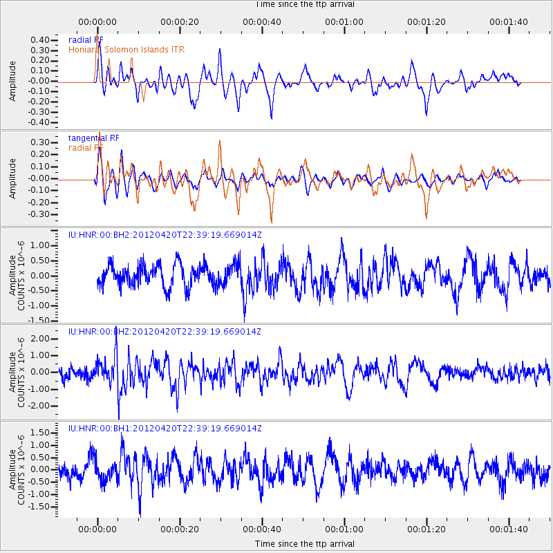
HNR Honiara, Solomon Islands - Earthquake Result Viewer
*The percent match for this event was below the threshold and hence no stack was calculated.
| Earthquake location: |
Off W Coast Of Northern Sumatra |
| Earthquake latitude/longitude: |
3.3/93.8 |
| Earthquake time(UTC): |
2012/04/20 (111) 22:28:59 GMT |
| Earthquake Depth: |
22 km |
| Earthquake Magnitude: |
5.9 MW, 5.6 MB, 5.7 MS |
| Earthquake Catalog/Contributor: |
NEIC PDE/NEIC PDE-M |
|
| Network: |
IU Global Seismograph Network (GSN - IRIS/USGS) |
| Station: |
HNR Honiara, Solomon Islands |
| Lat/Lon: |
9.44 S/159.95 E |
| Elevation: |
100 m |
|
| Distance: |
67.1 deg |
| Az: |
101.605 deg |
| Baz: |
277.594 deg |
| Ray Param: |
$rayparam |
*The percent match for this event was below the threshold and hence was not used in the summary stack. |
|
| Radial Match: |
64.15662 % |
| Radial Bump: |
400 |
| Transverse Match: |
59.381824 % |
| Transverse Bump: |
400 |
| SOD ConfigId: |
558545 |
| Insert Time: |
2013-09-19 16:38:13.501 +0000 |
| GWidth: |
2.5 |
| Max Bumps: |
400 |
| Tol: |
0.001 |
|
Signal To Noise
| Channel | StoN | STA | LTA |
| IU:HNR:00:BHZ:20120420T22:39:19.669014Z | 2.6925578 | 8.1321787E-7 | 3.020243E-7 |
| IU:HNR:00:BH1:20120420T22:39:19.669014Z | 1.3248631 | 4.0656397E-7 | 3.0687244E-7 |
| IU:HNR:00:BH2:20120420T22:39:19.669014Z | 1.0004547 | 3.5508947E-7 | 3.549281E-7 |
| Arrivals |
| Ps | |
| PpPs | |
| PsPs/PpSs | |


