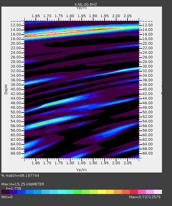
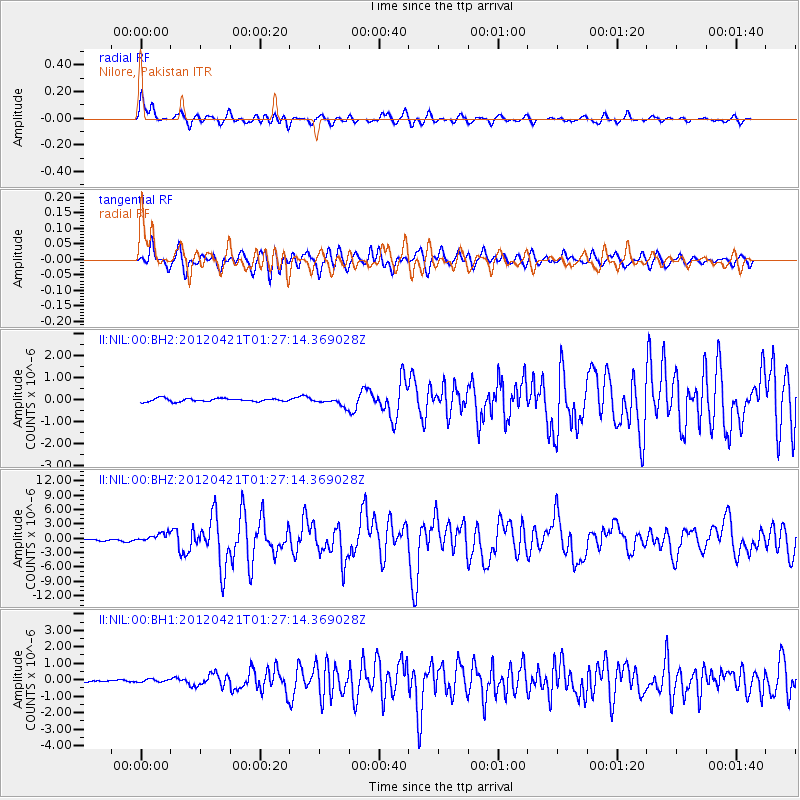
NIL Nilore, Pakistan - Earthquake Result Viewer

Earthquake location: Irian Jaya Region, Indonesia
Earthquake latitude/longitude: -1.6/134.3
Earthquake time(UTC): 2012/04/21 (112) 01:16:52 GMT
Earthquake Depth: 16 km
Earthquake Magnitude: 6.3 MB, 6.6 MS, 6.7 MW, 6.6 MW
Earthquake Catalog/Contributor: WHDF/NEIC
Network: II Global Seismograph Network (GSN - IRIS/IDA)
Station: NIL Nilore, Pakistan
Lat/Lon: 33.65 N/73.27 E
Elevation: 629 m
Distance: 67.1 deg
Az: 307.639 deg
Baz: 108.386 deg
Ray Param: 0.057146654
Estimated Moho Depth: 15.25 km
Estimated Crust Vp/Vs: 1.74
Assumed Crust Vp: 6.242 km/s
Estimated Crust Vs: 3.598 km/s
Estimated Crust Poisson's Ratio: 0.25
Radial Match: 89.187744 %
Radial Bump: 400
Transverse Match: 79.31726 %
Transverse Bump: 400
SOD ConfigId: 558545
Insert Time: 2013-09-19 16:41:38.752 +0000
GWidth: 2.5
Max Bumps: 400
Tol: 0.001

Signal To Noise

ChannelStoNSTALTA
II:NIL:00:BHZ:20120421T01:27:14.369028Z5.9244159.73554E-71.6432915E-7
II:NIL:00:BH1:20120421T01:27:14.369028Z1.12019158.604771E-87.681518E-8
II:NIL:00:BH2:20120421T01:27:14.369028Z2.6332751.8926012E-77.187253E-8
Arrivals
Ps1.9 SECOND
PpPs6.4 SECOND
PsPs/PpSs8.3 SECOND