
NWAO Narrogin, Australia - Earthquake Result Viewer
| ||||||||||||||||||
| ||||||||||||||||||
| ||||||||||||||||||
|
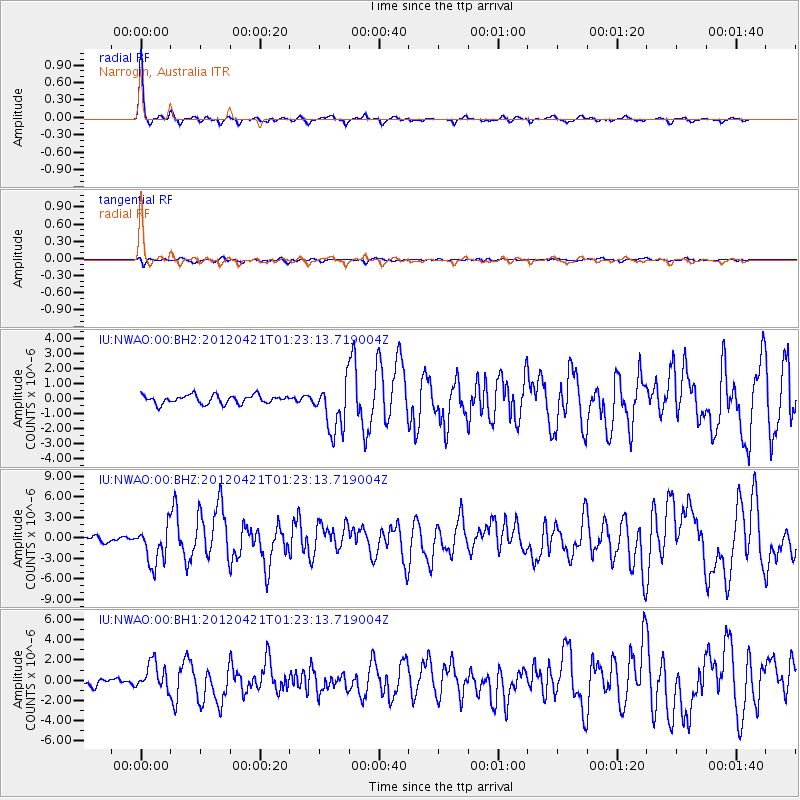
Signal To Noise
| Channel | StoN | STA | LTA |
| IU:NWAO:00:BHZ:20120421T01:23:13.719004Z | 7.3840003 | 2.8401703E-6 | 3.846384E-7 |
| IU:NWAO:00:BH1:20120421T01:23:13.719004Z | 5.001245 | 1.3590756E-6 | 2.7174744E-7 |
| IU:NWAO:00:BH2:20120421T01:23:13.719004Z | 5.773105 | 1.6544014E-6 | 2.8657047E-7 |
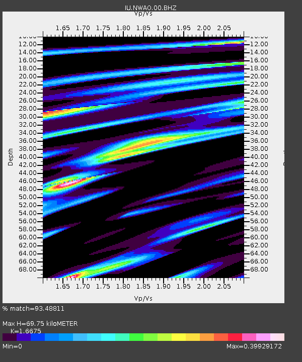
| Arrivals | |
| Ps | 7.9 SECOND |
| PpPs | 27 SECOND |
| PsPs/PpSs | 35 SECOND |

