SNZO South Karori, New Zealand - Earthquake Result Viewer
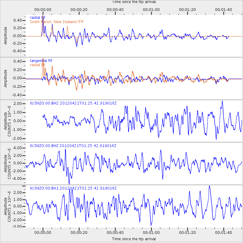
Earthquake location: Irian Jaya Region, Indonesia
Earthquake latitude/longitude: -1.6/134.3
Earthquake time(UTC): 2012/04/21 (112) 01:16:52 GMT
Earthquake Depth: 16 km
Earthquake Magnitude: 6.3 MB, 6.6 MS, 6.7 MW, 6.6 MW
Earthquake Catalog/Contributor: WHDF/NEIC
Network: IU Global Seismograph Network (GSN - IRIS/USGS)
Station: SNZO South Karori, New Zealand
Lat/Lon: 41.31 S/174.70 E
Elevation: 120 m
Distance: 53.7 deg
Az: 142.699 deg
Baz: 306.477 deg
Ray Param: 0.06589325
Estimated Moho Depth: 40.5 km
Estimated Crust Vp/Vs: 1.80
Assumed Crust Vp: 6.461 km/s
Estimated Crust Vs: 3.59 km/s
Estimated Crust Poisson's Ratio: 0.28
Radial Match: 81.48716 %
Radial Bump: 400
Transverse Match: 50.583855 %
Transverse Bump: 400
SOD ConfigId: 558545
Insert Time: 2013-09-19 16:42:32.148 +0000
GWidth: 2.5
Max Bumps: 400
Tol: 0.001

Signal To Noise

ChannelStoNSTALTA
IU:SNZO:00:BHZ:20120421T01:25:42.919016Z2.99281431.1844005E-63.957481E-7
IU:SNZO:00:BH1:20120421T01:25:42.919016Z1.01952664.9193346E-74.825116E-7
IU:SNZO:00:BH2:20120421T01:25:42.919016Z2.30648118.2672585E-73.58436E-7
Arrivals
Ps5.3 SECOND
PpPs17 SECOND
PsPs/PpSs22 SECOND