You are here: Home > Network List > US - United States National Seismic Network Stations List
> Station DUG Dugway, Tooele County, Utah, USA > Earthquake Result Viewer
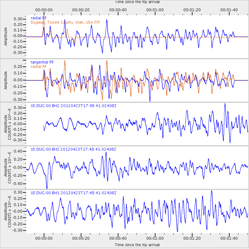
DUG Dugway, Tooele County, Utah, USA - Earthquake Result Viewer
*The percent match for this event was below the threshold and hence no stack was calculated.
| Earthquake location: |
Kermadec Islands Region |
| Earthquake latitude/longitude: |
-28.6/-177.4 |
| Earthquake time(UTC): |
2012/04/23 (114) 17:36:21 GMT |
| Earthquake Depth: |
114 km |
| Earthquake Magnitude: |
5.8 MB, 6.0 MW, 6.0 MW |
| Earthquake Catalog/Contributor: |
WHDF/NEIC |
|
| Network: |
US United States National Seismic Network |
| Station: |
DUG Dugway, Tooele County, Utah, USA |
| Lat/Lon: |
40.19 N/112.81 W |
| Elevation: |
1477 m |
|
| Distance: |
91.0 deg |
| Az: |
43.791 deg |
| Baz: |
232.632 deg |
| Ray Param: |
$rayparam |
*The percent match for this event was below the threshold and hence was not used in the summary stack. |
|
| Radial Match: |
62.72356 % |
| Radial Bump: |
400 |
| Transverse Match: |
67.1895 % |
| Transverse Bump: |
400 |
| SOD ConfigId: |
558545 |
| Insert Time: |
2013-09-19 16:50:57.177 +0000 |
| GWidth: |
2.5 |
| Max Bumps: |
400 |
| Tol: |
0.001 |
|
Signal To Noise
| Channel | StoN | STA | LTA |
| US:DUG:00:BHZ:20120423T17:48:41.02498Z | 3.237532 | 2.1127215E-7 | 6.525716E-8 |
| US:DUG:00:BH1:20120423T17:48:41.02498Z | 1.3408642 | 8.2538726E-8 | 6.155637E-8 |
| US:DUG:00:BH2:20120423T17:48:41.02498Z | 1.5491594 | 8.957427E-8 | 5.7821207E-8 |
| Arrivals |
| Ps | |
| PpPs | |
| PsPs/PpSs | |


