You are here: Home > Network List > CN - Canadian National Seismograph Network Stations List
> Station PMB Pemberton, British Columbia, Canada > Earthquake Result Viewer
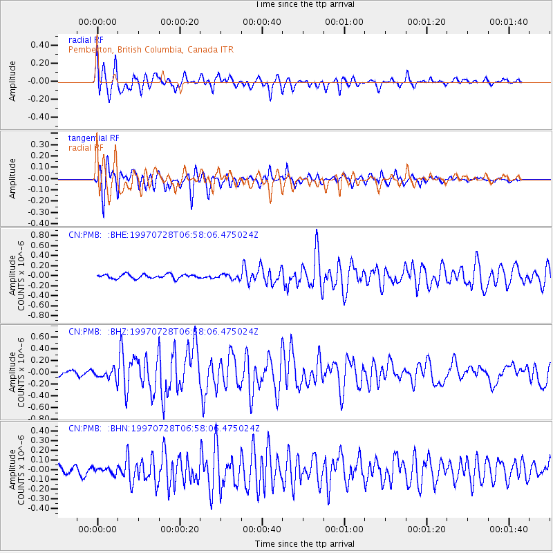
PMB Pemberton, British Columbia, Canada - Earthquake Result Viewer
*The percent match for this event was below the threshold and hence no stack was calculated.
| Earthquake location: |
Volcano Islands, Japan Region |
| Earthquake latitude/longitude: |
22.4/142.7 |
| Earthquake time(UTC): |
1997/07/28 (209) 06:46:55 GMT |
| Earthquake Depth: |
33 km |
| Earthquake Magnitude: |
5.7 MB, 5.8 MS, 5.9 UNKNOWN, 5.9 MW |
| Earthquake Catalog/Contributor: |
WHDF/NEIC |
|
| Network: |
CN Canadian National Seismograph Network |
| Station: |
PMB Pemberton, British Columbia, Canada |
| Lat/Lon: |
50.52 N/123.08 W |
| Elevation: |
400 m |
|
| Distance: |
75.6 deg |
| Az: |
41.085 deg |
| Baz: |
287.635 deg |
| Ray Param: |
$rayparam |
*The percent match for this event was below the threshold and hence was not used in the summary stack. |
|
| Radial Match: |
69.327835 % |
| Radial Bump: |
400 |
| Transverse Match: |
84.67408 % |
| Transverse Bump: |
400 |
| SOD ConfigId: |
4480 |
| Insert Time: |
2010-02-27 06:53:40.120 +0000 |
| GWidth: |
2.5 |
| Max Bumps: |
400 |
| Tol: |
0.001 |
|
Signal To Noise
| Channel | StoN | STA | LTA |
| CN:PMB: :BHZ:19970728T06:58:06.475024Z | 2.039625 | 8.800241E-8 | 4.3146372E-8 |
| CN:PMB: :BHN:19970728T06:58:06.475024Z | 0.83730483 | 2.9321738E-8 | 3.501919E-8 |
| CN:PMB: :BHE:19970728T06:58:06.475024Z | 1.2028176 | 4.935908E-8 | 4.1036216E-8 |
| Arrivals |
| Ps | |
| PpPs | |
| PsPs/PpSs | |


