You are here: Home > Network List > US - United States National Seismic Network Stations List
> Station ERPA Erie, Pennsylvania, USA > Earthquake Result Viewer
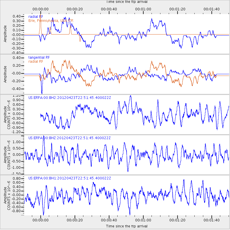
ERPA Erie, Pennsylvania, USA - Earthquake Result Viewer
*The percent match for this event was below the threshold and hence no stack was calculated.
| Earthquake location: |
Kuril Islands |
| Earthquake latitude/longitude: |
48.4/154.7 |
| Earthquake time(UTC): |
2012/04/23 (114) 22:40:22 GMT |
| Earthquake Depth: |
31 km |
| Earthquake Magnitude: |
5.6 MW, 5.2 MS, 5.4 MB, 5.7 MW |
| Earthquake Catalog/Contributor: |
WHDF/NEIC |
|
| Network: |
US United States National Seismic Network |
| Station: |
ERPA Erie, Pennsylvania, USA |
| Lat/Lon: |
42.12 N/79.99 W |
| Elevation: |
306 m |
|
| Distance: |
77.8 deg |
| Az: |
38.428 deg |
| Baz: |
326.169 deg |
| Ray Param: |
$rayparam |
*The percent match for this event was below the threshold and hence was not used in the summary stack. |
|
| Radial Match: |
47.8955 % |
| Radial Bump: |
400 |
| Transverse Match: |
48.10866 % |
| Transverse Bump: |
400 |
| SOD ConfigId: |
558545 |
| Insert Time: |
2013-09-19 16:56:49.852 +0000 |
| GWidth: |
2.5 |
| Max Bumps: |
400 |
| Tol: |
0.001 |
|
Signal To Noise
| Channel | StoN | STA | LTA |
| US:ERPA:00:BHZ:20120423T22:51:45.400022Z | 1.8962038 | 6.336164E-7 | 3.3414997E-7 |
| US:ERPA:00:BH1:20120423T22:51:45.400022Z | 1.4721665 | 4.8067506E-7 | 3.265086E-7 |
| US:ERPA:00:BH2:20120423T22:51:45.400022Z | 0.9435527 | 4.109877E-7 | 4.3557472E-7 |
| Arrivals |
| Ps | |
| PpPs | |
| PsPs/PpSs | |


