You are here: Home > Network List > US - United States National Seismic Network Stations List
> Station WVOR Wild Horse Valley, Oregon, USA > Earthquake Result Viewer
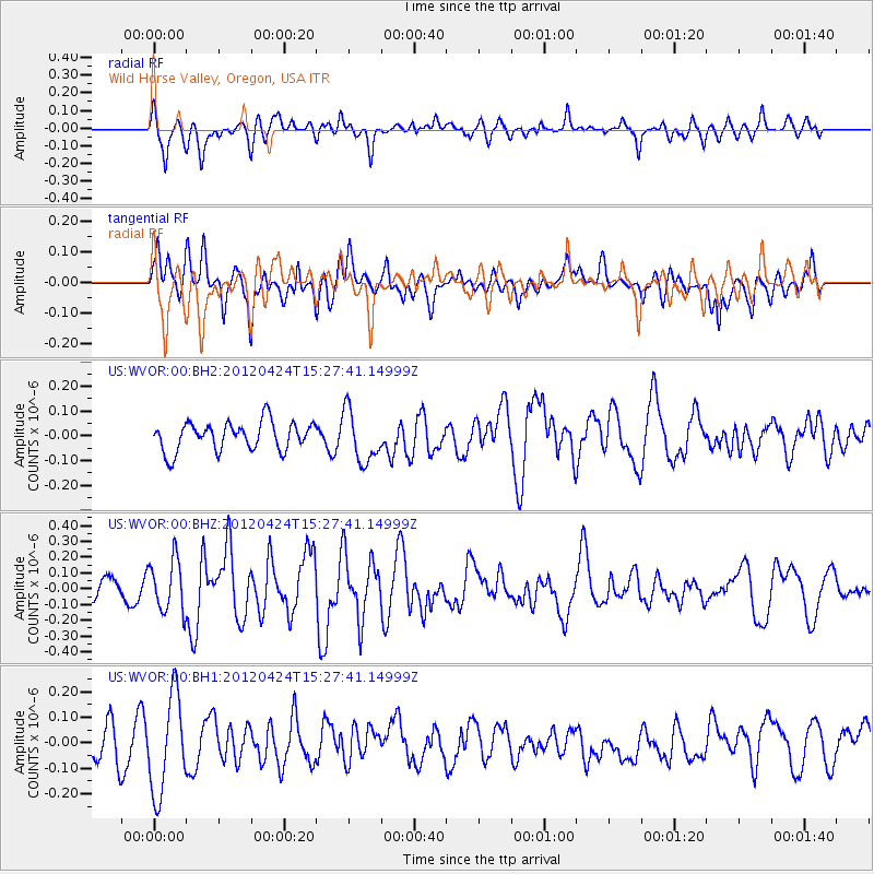
WVOR Wild Horse Valley, Oregon, USA - Earthquake Result Viewer
*The percent match for this event was below the threshold and hence no stack was calculated.
| Earthquake location: |
South Of Tonga Islands |
| Earthquake latitude/longitude: |
-24.2/-175.9 |
| Earthquake time(UTC): |
2012/04/24 (115) 15:15:38 GMT |
| Earthquake Depth: |
10 km |
| Earthquake Magnitude: |
5.6 MW, 5.6 MW, 5.6 MS |
| Earthquake Catalog/Contributor: |
NEIC PDE/NEIC PDE-M |
|
| Network: |
US United States National Seismic Network |
| Station: |
WVOR Wild Horse Valley, Oregon, USA |
| Lat/Lon: |
42.43 N/118.64 W |
| Elevation: |
1344 m |
|
| Distance: |
84.8 deg |
| Az: |
38.73 deg |
| Baz: |
230.493 deg |
| Ray Param: |
$rayparam |
*The percent match for this event was below the threshold and hence was not used in the summary stack. |
|
| Radial Match: |
62.429176 % |
| Radial Bump: |
400 |
| Transverse Match: |
44.54158 % |
| Transverse Bump: |
400 |
| SOD ConfigId: |
558545 |
| Insert Time: |
2013-09-19 17:04:13.965 +0000 |
| GWidth: |
2.5 |
| Max Bumps: |
400 |
| Tol: |
0.001 |
|
Signal To Noise
| Channel | StoN | STA | LTA |
| US:WVOR:00:BHZ:20120424T15:27:41.14999Z | 2.3831408 | 1.653607E-7 | 6.938772E-8 |
| US:WVOR:00:BH1:20120424T15:27:41.14999Z | 2.638845 | 1.8964934E-7 | 7.1868314E-8 |
| US:WVOR:00:BH2:20120424T15:27:41.14999Z | 1.811754 | 1.04088784E-7 | 5.7451942E-8 |
| Arrivals |
| Ps | |
| PpPs | |
| PsPs/PpSs | |


