You are here: Home > Network List > II - Global Seismograph Network (GSN - IRIS/IDA) Stations List
> Station WRAB Tennant Creek, NT, Australia > Earthquake Result Viewer
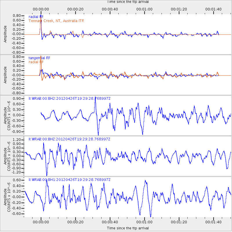
WRAB Tennant Creek, NT, Australia - Earthquake Result Viewer
*The percent match for this event was below the threshold and hence no stack was calculated.
| Earthquake location: |
Off W Coast Of Northern Sumatra |
| Earthquake latitude/longitude: |
2.7/94.5 |
| Earthquake time(UTC): |
2012/04/26 (117) 19:21:42 GMT |
| Earthquake Depth: |
7.9 km |
| Earthquake Magnitude: |
5.5 MB, 5.6 MW |
| Earthquake Catalog/Contributor: |
NEIC PDE/NEIC PDE-M |
|
| Network: |
II Global Seismograph Network (GSN - IRIS/IDA) |
| Station: |
WRAB Tennant Creek, NT, Australia |
| Lat/Lon: |
19.93 S/134.36 E |
| Elevation: |
366 m |
|
| Distance: |
45.2 deg |
| Az: |
121.668 deg |
| Baz: |
295.357 deg |
| Ray Param: |
$rayparam |
*The percent match for this event was below the threshold and hence was not used in the summary stack. |
|
| Radial Match: |
66.794525 % |
| Radial Bump: |
400 |
| Transverse Match: |
64.18406 % |
| Transverse Bump: |
400 |
| SOD ConfigId: |
558545 |
| Insert Time: |
2013-09-19 17:10:36.413 +0000 |
| GWidth: |
2.5 |
| Max Bumps: |
400 |
| Tol: |
0.001 |
|
Signal To Noise
| Channel | StoN | STA | LTA |
| II:WRAB:00:BHZ:20120426T19:29:28.768997Z | 2.3665774 | 5.965654E-7 | 2.520794E-7 |
| II:WRAB:00:BH1:20120426T19:29:28.768997Z | 2.0501845 | 3.008756E-7 | 1.4675538E-7 |
| II:WRAB:00:BH2:20120426T19:29:28.768997Z | 2.9763029 | 4.827485E-7 | 1.6219737E-7 |
| Arrivals |
| Ps | |
| PpPs | |
| PsPs/PpSs | |


