You are here: Home > Network List > IU - Global Seismograph Network (GSN - IRIS/USGS) Stations List
> Station HNR Honiara, Solomon Islands > Earthquake Result Viewer
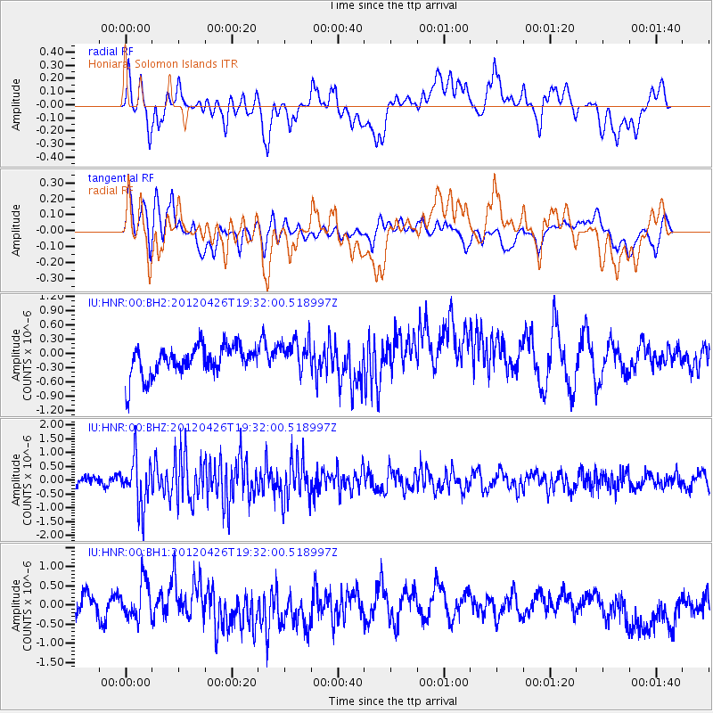
HNR Honiara, Solomon Islands - Earthquake Result Viewer
*The percent match for this event was below the threshold and hence no stack was calculated.
| Earthquake location: |
Off W Coast Of Northern Sumatra |
| Earthquake latitude/longitude: |
2.7/94.5 |
| Earthquake time(UTC): |
2012/04/26 (117) 19:21:42 GMT |
| Earthquake Depth: |
7.9 km |
| Earthquake Magnitude: |
5.5 MB, 5.6 MW |
| Earthquake Catalog/Contributor: |
NEIC PDE/NEIC PDE-M |
|
| Network: |
IU Global Seismograph Network (GSN - IRIS/USGS) |
| Station: |
HNR Honiara, Solomon Islands |
| Lat/Lon: |
9.44 S/159.95 E |
| Elevation: |
100 m |
|
| Distance: |
66.3 deg |
| Az: |
101.453 deg |
| Baz: |
277.125 deg |
| Ray Param: |
$rayparam |
*The percent match for this event was below the threshold and hence was not used in the summary stack. |
|
| Radial Match: |
49.224216 % |
| Radial Bump: |
400 |
| Transverse Match: |
46.8908 % |
| Transverse Bump: |
400 |
| SOD ConfigId: |
558545 |
| Insert Time: |
2013-09-19 17:10:48.351 +0000 |
| GWidth: |
2.5 |
| Max Bumps: |
400 |
| Tol: |
0.001 |
|
Signal To Noise
| Channel | StoN | STA | LTA |
| IU:HNR:00:BHZ:20120426T19:32:00.518997Z | 3.3204925 | 8.897141E-7 | 2.6794643E-7 |
| IU:HNR:00:BH1:20120426T19:32:00.518997Z | 1.0696095 | 4.7500296E-7 | 4.4409006E-7 |
| IU:HNR:00:BH2:20120426T19:32:00.518997Z | 1.0950568 | 3.4191794E-7 | 3.1223763E-7 |
| Arrivals |
| Ps | |
| PpPs | |
| PsPs/PpSs | |


