You are here: Home > Network List > TA - USArray Transportable Network (new EarthScope stations) Stations List
> Station R11A Troy Canyon, Currant, NV, USA > Earthquake Result Viewer
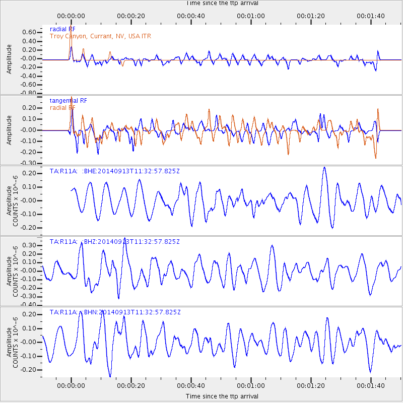
R11A Troy Canyon, Currant, NV, USA - Earthquake Result Viewer
*The percent match for this event was below the threshold and hence no stack was calculated.
| Earthquake location: |
Near Coast Of Chiapas, Mexico |
| Earthquake latitude/longitude: |
14.5/-93.6 |
| Earthquake time(UTC): |
2014/09/13 (256) 11:27:16 GMT |
| Earthquake Depth: |
27 km |
| Earthquake Magnitude: |
5.3 MW |
| Earthquake Catalog/Contributor: |
ISC/ISC |
|
| Network: |
TA USArray Transportable Network (new EarthScope stations) |
| Station: |
R11A Troy Canyon, Currant, NV, USA |
| Lat/Lon: |
38.35 N/115.59 W |
| Elevation: |
1756 m |
|
| Distance: |
30.6 deg |
| Az: |
324.793 deg |
| Baz: |
134.759 deg |
| Ray Param: |
$rayparam |
*The percent match for this event was below the threshold and hence was not used in the summary stack. |
|
| Radial Match: |
40.752563 % |
| Radial Bump: |
400 |
| Transverse Match: |
61.86915 % |
| Transverse Bump: |
400 |
| SOD ConfigId: |
3390531 |
| Insert Time: |
2019-04-14 00:50:52.657 +0000 |
| GWidth: |
2.5 |
| Max Bumps: |
400 |
| Tol: |
0.001 |
|
Signal To Noise
| Channel | StoN | STA | LTA |
| TA:R11A: :BHZ:20140913T11:32:57.825Z | 2.2863533 | 1.5816175E-7 | 6.917643E-8 |
| TA:R11A: :BHN:20140913T11:32:57.825Z | 1.8253738 | 1.2902225E-7 | 7.0682646E-8 |
| TA:R11A: :BHE:20140913T11:32:57.825Z | 0.7010955 | 5.835423E-8 | 8.3232926E-8 |
| Arrivals |
| Ps | |
| PpPs | |
| PsPs/PpSs | |


