You are here: Home > Network List > US - United States National Seismic Network Stations List
> Station WRAK Wrangell Island, Southeastern Alaska, Alaska, USA > Earthquake Result Viewer
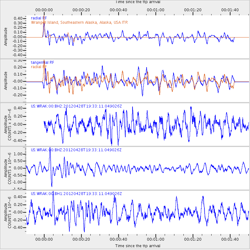
WRAK Wrangell Island, Southeastern Alaska, Alaska, USA - Earthquake Result Viewer
*The percent match for this event was below the threshold and hence no stack was calculated.
| Earthquake location: |
New Britain Region, P.N.G. |
| Earthquake latitude/longitude: |
-5.3/152.1 |
| Earthquake time(UTC): |
2012/04/28 (119) 19:21:03 GMT |
| Earthquake Depth: |
35 km |
| Earthquake Magnitude: |
5.6 MW |
| Earthquake Catalog/Contributor: |
NEIC PDE/NEIC PDE-M |
|
| Network: |
US United States National Seismic Network |
| Station: |
WRAK Wrangell Island, Southeastern Alaska, Alaska, USA |
| Lat/Lon: |
56.42 N/132.35 W |
| Elevation: |
81 m |
|
| Distance: |
86.5 deg |
| Az: |
32.624 deg |
| Baz: |
255.024 deg |
| Ray Param: |
$rayparam |
*The percent match for this event was below the threshold and hence was not used in the summary stack. |
|
| Radial Match: |
65.238976 % |
| Radial Bump: |
400 |
| Transverse Match: |
62.208447 % |
| Transverse Bump: |
400 |
| SOD ConfigId: |
558545 |
| Insert Time: |
2013-09-19 17:20:07.116 +0000 |
| GWidth: |
2.5 |
| Max Bumps: |
400 |
| Tol: |
0.001 |
|
Signal To Noise
| Channel | StoN | STA | LTA |
| US:WRAK:00:BHZ:20120428T19:33:11.049026Z | 2.5241857 | 5.691496E-7 | 2.254785E-7 |
| US:WRAK:00:BH1:20120428T19:33:11.049026Z | 0.9499238 | 1.424992E-7 | 1.5001119E-7 |
| US:WRAK:00:BH2:20120428T19:33:11.049026Z | 1.248892 | 1.8836253E-7 | 1.5082372E-7 |
| Arrivals |
| Ps | |
| PpPs | |
| PsPs/PpSs | |


