You are here: Home > Network List > II - Global Seismograph Network (GSN - IRIS/IDA) Stations List
> Station WRAB Tennant Creek, NT, Australia > Earthquake Result Viewer
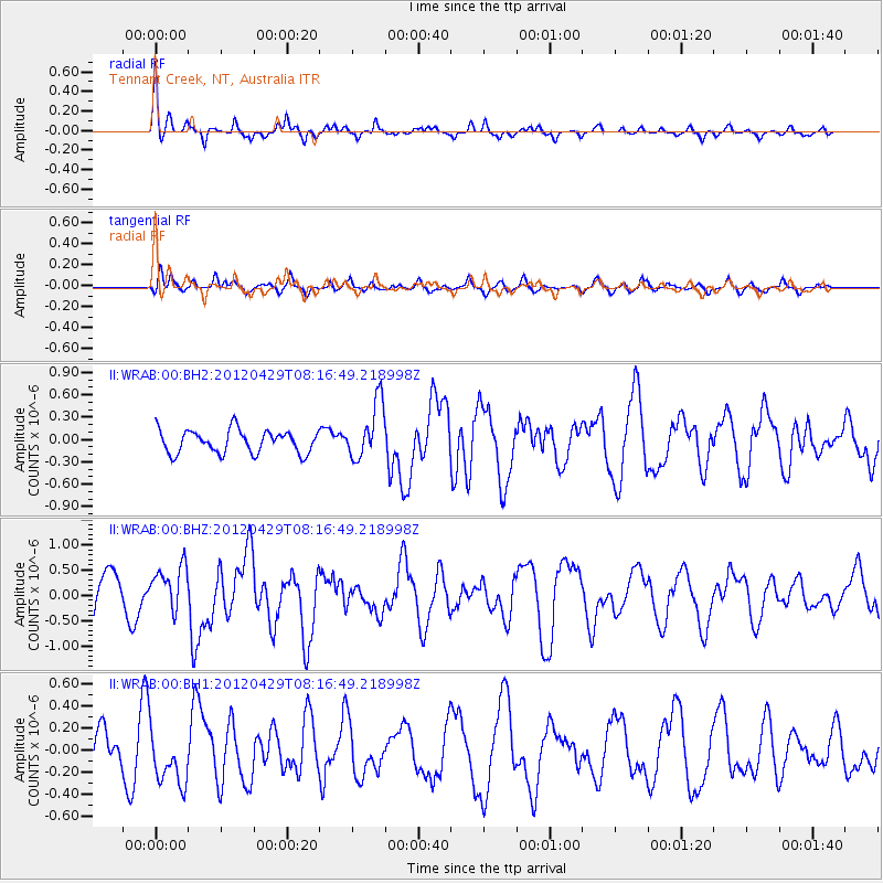
WRAB Tennant Creek, NT, Australia - Earthquake Result Viewer
*The percent match for this event was below the threshold and hence no stack was calculated.
| Earthquake location: |
Off W Coast Of Northern Sumatra |
| Earthquake latitude/longitude: |
2.7/94.5 |
| Earthquake time(UTC): |
2012/04/29 (120) 08:09:04 GMT |
| Earthquake Depth: |
14 km |
| Earthquake Magnitude: |
5.8 MW, 5.7 MW, 5.9 MS |
| Earthquake Catalog/Contributor: |
NEIC PDE/NEIC PDE-M |
|
| Network: |
II Global Seismograph Network (GSN - IRIS/IDA) |
| Station: |
WRAB Tennant Creek, NT, Australia |
| Lat/Lon: |
19.93 S/134.36 E |
| Elevation: |
366 m |
|
| Distance: |
45.1 deg |
| Az: |
121.703 deg |
| Baz: |
295.404 deg |
| Ray Param: |
$rayparam |
*The percent match for this event was below the threshold and hence was not used in the summary stack. |
|
| Radial Match: |
64.28797 % |
| Radial Bump: |
281 |
| Transverse Match: |
53.366096 % |
| Transverse Bump: |
400 |
| SOD ConfigId: |
558545 |
| Insert Time: |
2013-09-19 17:21:12.133 +0000 |
| GWidth: |
2.5 |
| Max Bumps: |
400 |
| Tol: |
0.001 |
|
Signal To Noise
| Channel | StoN | STA | LTA |
| II:WRAB:00:BHZ:20120429T08:16:49.218998Z | 1.5376849 | 4.4653447E-7 | 2.9039398E-7 |
| II:WRAB:00:BH1:20120429T08:16:49.218998Z | 1.3025405 | 2.5198972E-7 | 1.9346018E-7 |
| II:WRAB:00:BH2:20120429T08:16:49.218998Z | 2.4686835 | 3.809107E-7 | 1.542971E-7 |
| Arrivals |
| Ps | |
| PpPs | |
| PsPs/PpSs | |


