You are here: Home > Network List > CN - Canadian National Seismograph Network Stations List
> Station PMB Pemberton, British Columbia, Canada > Earthquake Result Viewer
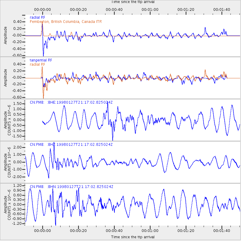
PMB Pemberton, British Columbia, Canada - Earthquake Result Viewer
*The percent match for this event was below the threshold and hence no stack was calculated.
| Earthquake location: |
South Of Fiji Islands |
| Earthquake latitude/longitude: |
-22.4/179.0 |
| Earthquake time(UTC): |
1998/01/27 (027) 21:05:44 GMT |
| Earthquake Depth: |
610 km |
| Earthquake Magnitude: |
5.6 MB, 6.5 UNKNOWN, 6.4 MW |
| Earthquake Catalog/Contributor: |
WHDF/NEIC |
|
| Network: |
CN Canadian National Seismograph Network |
| Station: |
PMB Pemberton, British Columbia, Canada |
| Lat/Lon: |
50.52 N/123.08 W |
| Elevation: |
400 m |
|
| Distance: |
88.7 deg |
| Az: |
32.741 deg |
| Baz: |
231.628 deg |
| Ray Param: |
$rayparam |
*The percent match for this event was below the threshold and hence was not used in the summary stack. |
|
| Radial Match: |
61.624897 % |
| Radial Bump: |
400 |
| Transverse Match: |
58.016785 % |
| Transverse Bump: |
396 |
| SOD ConfigId: |
4480 |
| Insert Time: |
2010-02-27 06:54:37.291 +0000 |
| GWidth: |
2.5 |
| Max Bumps: |
400 |
| Tol: |
0.001 |
|
Signal To Noise
| Channel | StoN | STA | LTA |
| CN:PMB: :BHZ:19980127T21:17:02.825024Z | 1.6227208 | 1.0500071E-6 | 6.470658E-7 |
| CN:PMB: :BHN:19980127T21:17:02.825024Z | 0.99088484 | 4.1059258E-7 | 4.1436962E-7 |
| CN:PMB: :BHE:19980127T21:17:02.825024Z | 0.91922545 | 5.523597E-7 | 6.008969E-7 |
| Arrivals |
| Ps | |
| PpPs | |
| PsPs/PpSs | |


