You are here: Home > Network List > GS - US Geological Survey Networks Stations List
> Station DEC12 Decatur Surface Seismic Site, Decatur, IL, USA > Earthquake Result Viewer
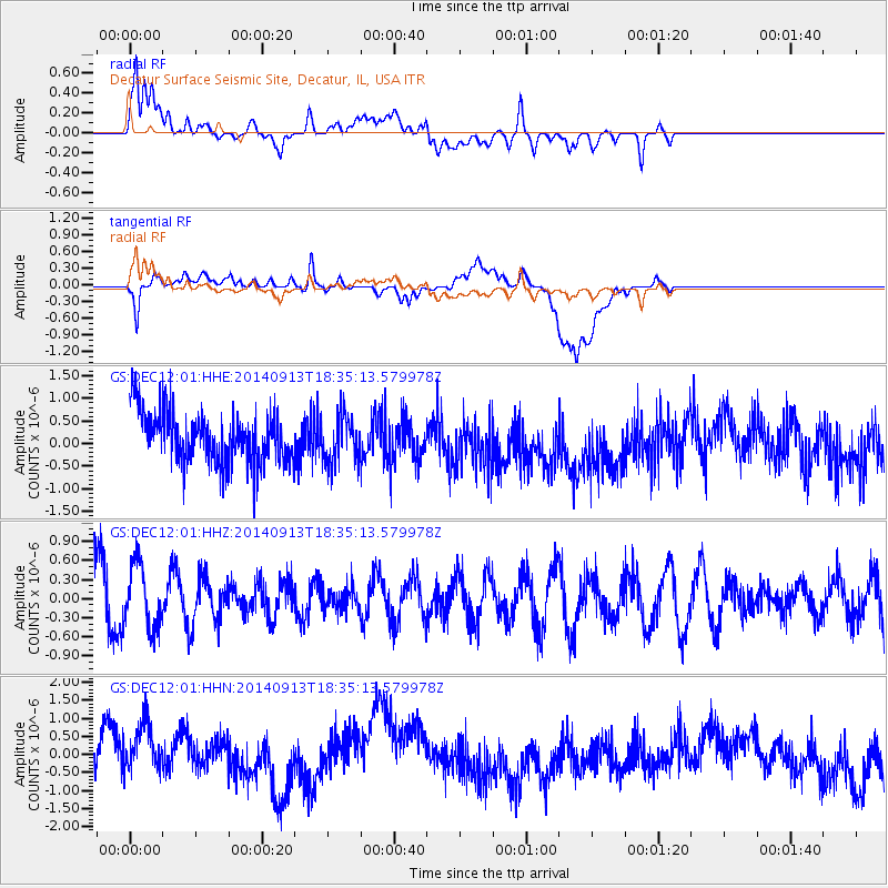
DEC12 Decatur Surface Seismic Site, Decatur, IL, USA - Earthquake Result Viewer
*The percent match for this event was below the threshold and hence no stack was calculated.
| Earthquake location: |
Tonga Islands |
| Earthquake latitude/longitude: |
-17.8/-173.2 |
| Earthquake time(UTC): |
2014/09/13 (256) 18:22:14 GMT |
| Earthquake Depth: |
12 km |
| Earthquake Magnitude: |
5.3 MW |
| Earthquake Catalog/Contributor: |
ISC/ISC |
|
| Network: |
GS US Geological Survey Networks |
| Station: |
DEC12 Decatur Surface Seismic Site, Decatur, IL, USA |
| Lat/Lon: |
39.91 N/88.91 W |
| Elevation: |
208 m |
|
| Distance: |
97.0 deg |
| Az: |
50.448 deg |
| Baz: |
252.736 deg |
| Ray Param: |
$rayparam |
*The percent match for this event was below the threshold and hence was not used in the summary stack. |
|
| Radial Match: |
59.32851 % |
| Radial Bump: |
400 |
| Transverse Match: |
39.908386 % |
| Transverse Bump: |
400 |
| SOD ConfigId: |
3390531 |
| Insert Time: |
2019-04-14 00:55:13.473 +0000 |
| GWidth: |
2.5 |
| Max Bumps: |
400 |
| Tol: |
0.001 |
|
Signal To Noise
| Channel | StoN | STA | LTA |
| GS:DEC12:01:HHZ:20140913T18:35:13.579978Z | 1.3859459 | 5.0627926E-7 | 3.6529508E-7 |
| GS:DEC12:01:HHN:20140913T18:35:13.579978Z | 1.5262787 | 9.3038835E-7 | 6.095796E-7 |
| GS:DEC12:01:HHE:20140913T18:35:13.579978Z | 0.91498697 | 5.331566E-7 | 5.826931E-7 |
| Arrivals |
| Ps | |
| PpPs | |
| PsPs/PpSs | |


