You are here: Home > Network List > IU - Global Seismograph Network (GSN - IRIS/USGS) Stations List
> Station JOHN Johnston Island, USA > Earthquake Result Viewer
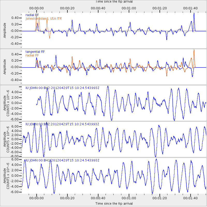
JOHN Johnston Island, USA - Earthquake Result Viewer
*The percent match for this event was below the threshold and hence no stack was calculated.
| Earthquake location: |
Near East Coast Of Honshu, Japan |
| Earthquake latitude/longitude: |
39.7/142.0 |
| Earthquake time(UTC): |
2012/04/29 (120) 15:02:18 GMT |
| Earthquake Depth: |
10 km |
| Earthquake Magnitude: |
5.5 MW, 5.6 MW, 5.8 MB |
| Earthquake Catalog/Contributor: |
NEIC PDE/NEIC PDE-M |
|
| Network: |
IU Global Seismograph Network (GSN - IRIS/USGS) |
| Station: |
JOHN Johnston Island, USA |
| Lat/Lon: |
16.73 N/169.53 W |
| Elevation: |
2.0 m |
|
| Distance: |
47.7 deg |
| Az: |
104.413 deg |
| Baz: |
308.801 deg |
| Ray Param: |
$rayparam |
*The percent match for this event was below the threshold and hence was not used in the summary stack. |
|
| Radial Match: |
55.4939 % |
| Radial Bump: |
400 |
| Transverse Match: |
60.644794 % |
| Transverse Bump: |
400 |
| SOD ConfigId: |
558545 |
| Insert Time: |
2013-09-19 17:28:43.425 +0000 |
| GWidth: |
2.5 |
| Max Bumps: |
400 |
| Tol: |
0.001 |
|
Signal To Noise
| Channel | StoN | STA | LTA |
| IU:JOHN:00:BHZ:20120429T15:10:24.543993Z | 2.730625 | 4.8438937E-6 | 1.773914E-6 |
| IU:JOHN:00:BH1:20120429T15:10:24.543993Z | 0.9282041 | 2.2922789E-6 | 2.4695848E-6 |
| IU:JOHN:00:BH2:20120429T15:10:24.543993Z | 1.0109686 | 2.5932798E-6 | 2.5651436E-6 |
| Arrivals |
| Ps | |
| PpPs | |
| PsPs/PpSs | |


