You are here: Home > Network List > IU - Global Seismograph Network (GSN - IRIS/USGS) Stations List
> Station RSSD Black Hills, South Dakota, USA > Earthquake Result Viewer
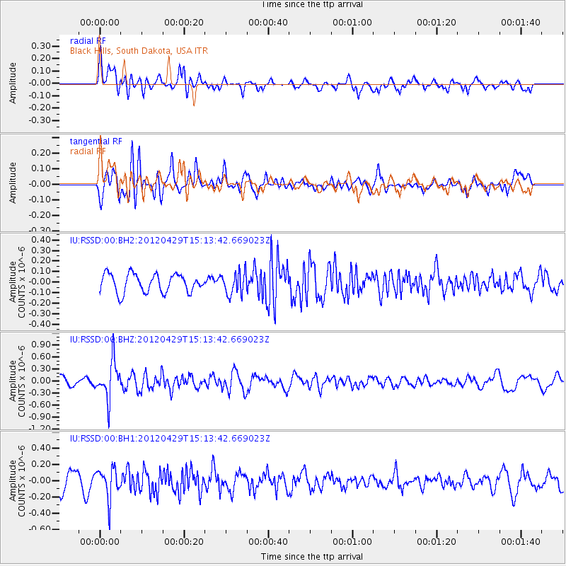
RSSD Black Hills, South Dakota, USA - Earthquake Result Viewer
*The percent match for this event was below the threshold and hence no stack was calculated.
| Earthquake location: |
Near East Coast Of Honshu, Japan |
| Earthquake latitude/longitude: |
39.7/142.0 |
| Earthquake time(UTC): |
2012/04/29 (120) 15:02:18 GMT |
| Earthquake Depth: |
10 km |
| Earthquake Magnitude: |
5.5 MW, 5.6 MW, 5.8 MB |
| Earthquake Catalog/Contributor: |
NEIC PDE/NEIC PDE-M |
|
| Network: |
IU Global Seismograph Network (GSN - IRIS/USGS) |
| Station: |
RSSD Black Hills, South Dakota, USA |
| Lat/Lon: |
44.12 N/104.04 W |
| Elevation: |
2090 m |
|
| Distance: |
77.5 deg |
| Az: |
42.401 deg |
| Baz: |
313.79 deg |
| Ray Param: |
$rayparam |
*The percent match for this event was below the threshold and hence was not used in the summary stack. |
|
| Radial Match: |
51.138622 % |
| Radial Bump: |
400 |
| Transverse Match: |
66.968315 % |
| Transverse Bump: |
400 |
| SOD ConfigId: |
558545 |
| Insert Time: |
2013-09-19 17:29:02.487 +0000 |
| GWidth: |
2.5 |
| Max Bumps: |
400 |
| Tol: |
0.001 |
|
Signal To Noise
| Channel | StoN | STA | LTA |
| IU:RSSD:00:BHZ:20120429T15:13:42.669023Z | 3.8742135 | 4.763817E-7 | 1.2296218E-7 |
| IU:RSSD:00:BH1:20120429T15:13:42.669023Z | 2.1007226 | 1.937471E-7 | 9.222879E-8 |
| IU:RSSD:00:BH2:20120429T15:13:42.669023Z | 1.23209 | 1.0730914E-7 | 8.7095216E-8 |
| Arrivals |
| Ps | |
| PpPs | |
| PsPs/PpSs | |


