You are here: Home > Network List > US - United States National Seismic Network Stations List
> Station ERPA Erie, Pennsylvania, USA > Earthquake Result Viewer
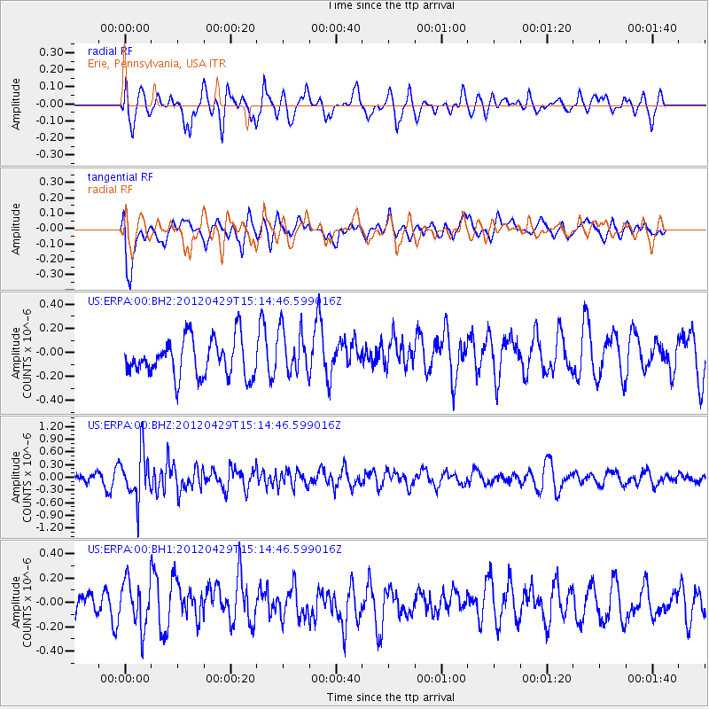
ERPA Erie, Pennsylvania, USA - Earthquake Result Viewer
*The percent match for this event was below the threshold and hence no stack was calculated.
| Earthquake location: |
Near East Coast Of Honshu, Japan |
| Earthquake latitude/longitude: |
39.7/142.0 |
| Earthquake time(UTC): |
2012/04/29 (120) 15:02:18 GMT |
| Earthquake Depth: |
10 km |
| Earthquake Magnitude: |
5.5 MW, 5.6 MW, 5.8 MB |
| Earthquake Catalog/Contributor: |
NEIC PDE/NEIC PDE-M |
|
| Network: |
US United States National Seismic Network |
| Station: |
ERPA Erie, Pennsylvania, USA |
| Lat/Lon: |
42.12 N/79.99 W |
| Elevation: |
306 m |
|
| Distance: |
90.0 deg |
| Az: |
29.874 deg |
| Baz: |
328.925 deg |
| Ray Param: |
$rayparam |
*The percent match for this event was below the threshold and hence was not used in the summary stack. |
|
| Radial Match: |
59.47814 % |
| Radial Bump: |
400 |
| Transverse Match: |
52.683537 % |
| Transverse Bump: |
400 |
| SOD ConfigId: |
558545 |
| Insert Time: |
2013-09-19 17:29:57.842 +0000 |
| GWidth: |
2.5 |
| Max Bumps: |
400 |
| Tol: |
0.001 |
|
Signal To Noise
| Channel | StoN | STA | LTA |
| US:ERPA:00:BHZ:20120429T15:14:46.599016Z | 3.3966131 | 5.670399E-7 | 1.6694273E-7 |
| US:ERPA:00:BH1:20120429T15:14:46.599016Z | 2.0938601 | 1.9591982E-7 | 9.356873E-8 |
| US:ERPA:00:BH2:20120429T15:14:46.599016Z | 1.2302343 | 1.9286198E-7 | 1.567685E-7 |
| Arrivals |
| Ps | |
| PpPs | |
| PsPs/PpSs | |


