You are here: Home > Network List > TA - USArray Transportable Network (new EarthScope stations) Stations List
> Station J01E Myrtle Point, OR, USA > Earthquake Result Viewer
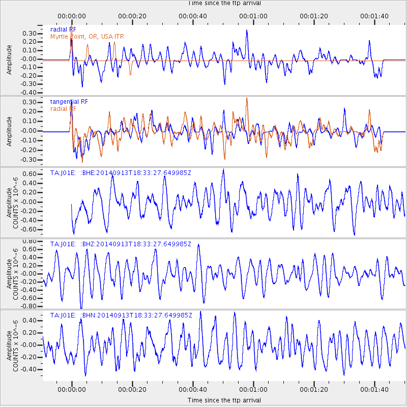
J01E Myrtle Point, OR, USA - Earthquake Result Viewer
*The percent match for this event was below the threshold and hence no stack was calculated.
| Earthquake location: |
Tonga Islands |
| Earthquake latitude/longitude: |
-17.8/-173.2 |
| Earthquake time(UTC): |
2014/09/13 (256) 18:22:14 GMT |
| Earthquake Depth: |
12 km |
| Earthquake Magnitude: |
5.3 MW |
| Earthquake Catalog/Contributor: |
ISC/ISC |
|
| Network: |
TA USArray Transportable Network (new EarthScope stations) |
| Station: |
J01E Myrtle Point, OR, USA |
| Lat/Lon: |
43.16 N/123.93 W |
| Elevation: |
128 m |
|
| Distance: |
75.7 deg |
| Az: |
34.901 deg |
| Baz: |
228.153 deg |
| Ray Param: |
$rayparam |
*The percent match for this event was below the threshold and hence was not used in the summary stack. |
|
| Radial Match: |
50.93733 % |
| Radial Bump: |
400 |
| Transverse Match: |
51.2959 % |
| Transverse Bump: |
400 |
| SOD ConfigId: |
3390531 |
| Insert Time: |
2019-04-14 00:57:21.407 +0000 |
| GWidth: |
2.5 |
| Max Bumps: |
400 |
| Tol: |
0.001 |
|
Signal To Noise
| Channel | StoN | STA | LTA |
| TA:J01E: :BHZ:20140913T18:33:27.649985Z | 1.3643346 | 3.9617564E-7 | 2.9038014E-7 |
| TA:J01E: :BHN:20140913T18:33:27.649985Z | 1.1968809 | 2.7852707E-7 | 2.3271076E-7 |
| TA:J01E: :BHE:20140913T18:33:27.649985Z | 1.1842717 | 3.3539612E-7 | 2.8320875E-7 |
| Arrivals |
| Ps | |
| PpPs | |
| PsPs/PpSs | |


