You are here: Home > Network List > IU - Global Seismograph Network (GSN - IRIS/USGS) Stations List
> Station HNR Honiara, Solomon Islands > Earthquake Result Viewer
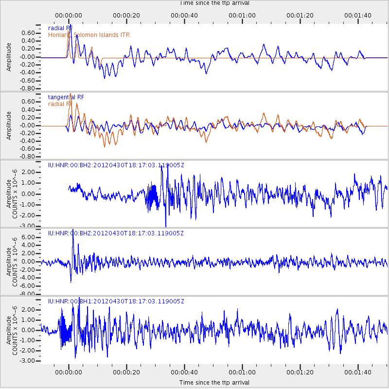
HNR Honiara, Solomon Islands - Earthquake Result Viewer
*The percent match for this event was below the threshold and hence no stack was calculated.
| Earthquake location: |
Banda Sea |
| Earthquake latitude/longitude: |
-5.7/128.5 |
| Earthquake time(UTC): |
2012/04/30 (121) 18:11:44 GMT |
| Earthquake Depth: |
356 km |
| Earthquake Magnitude: |
5.5 MW, 5.4 MB, 5.6 MW |
| Earthquake Catalog/Contributor: |
WHDF/NEIC |
|
| Network: |
IU Global Seismograph Network (GSN - IRIS/USGS) |
| Station: |
HNR Honiara, Solomon Islands |
| Lat/Lon: |
9.44 S/159.95 E |
| Elevation: |
100 m |
|
| Distance: |
31.4 deg |
| Az: |
98.754 deg |
| Baz: |
274.536 deg |
| Ray Param: |
$rayparam |
*The percent match for this event was below the threshold and hence was not used in the summary stack. |
|
| Radial Match: |
62.577396 % |
| Radial Bump: |
400 |
| Transverse Match: |
63.32535 % |
| Transverse Bump: |
400 |
| SOD ConfigId: |
558545 |
| Insert Time: |
2013-09-19 17:38:06.344 +0000 |
| GWidth: |
2.5 |
| Max Bumps: |
400 |
| Tol: |
0.001 |
|
Signal To Noise
| Channel | StoN | STA | LTA |
| IU:HNR:00:BHZ:20120430T18:17:03.119005Z | 5.9119916 | 2.5535435E-6 | 4.319261E-7 |
| IU:HNR:00:BH1:20120430T18:17:03.119005Z | 4.0069127 | 1.246684E-6 | 3.1113328E-7 |
| IU:HNR:00:BH2:20120430T18:17:03.119005Z | 3.2535374 | 1.2023603E-6 | 3.6955478E-7 |
| Arrivals |
| Ps | |
| PpPs | |
| PsPs/PpSs | |


