You are here: Home > Network List > US - United States National Seismic Network Stations List
> Station MSO Missoula, Montana, USA > Earthquake Result Viewer
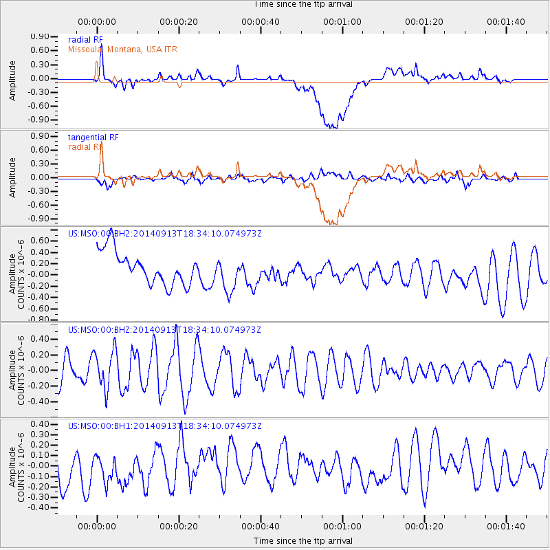
MSO Missoula, Montana, USA - Earthquake Result Viewer
*The percent match for this event was below the threshold and hence no stack was calculated.
| Earthquake location: |
Tonga Islands |
| Earthquake latitude/longitude: |
-17.8/-173.2 |
| Earthquake time(UTC): |
2014/09/13 (256) 18:22:14 GMT |
| Earthquake Depth: |
12 km |
| Earthquake Magnitude: |
5.3 MW |
| Earthquake Catalog/Contributor: |
ISC/ISC |
|
| Network: |
US United States National Seismic Network |
| Station: |
MSO Missoula, Montana, USA |
| Lat/Lon: |
46.83 N/113.94 W |
| Elevation: |
1264 m |
|
| Distance: |
83.5 deg |
| Az: |
36.431 deg |
| Baz: |
235.484 deg |
| Ray Param: |
$rayparam |
*The percent match for this event was below the threshold and hence was not used in the summary stack. |
|
| Radial Match: |
62.455208 % |
| Radial Bump: |
400 |
| Transverse Match: |
49.652355 % |
| Transverse Bump: |
400 |
| SOD ConfigId: |
3390531 |
| Insert Time: |
2019-04-14 00:57:59.742 +0000 |
| GWidth: |
2.5 |
| Max Bumps: |
400 |
| Tol: |
0.001 |
|
Signal To Noise
| Channel | StoN | STA | LTA |
| US:MSO:00:BHZ:20140913T18:34:10.074973Z | 1.6448444 | 2.4869678E-7 | 1.5119775E-7 |
| US:MSO:00:BH1:20140913T18:34:10.074973Z | 0.6673159 | 1.8839097E-7 | 2.8231153E-7 |
| US:MSO:00:BH2:20140913T18:34:10.074973Z | 1.1006722 | 3.1744224E-7 | 2.8840762E-7 |
| Arrivals |
| Ps | |
| PpPs | |
| PsPs/PpSs | |


