You are here: Home > Network List > US - United States National Seismic Network Stations List
> Station DGMT Dagmar, Montana, USA > Earthquake Result Viewer
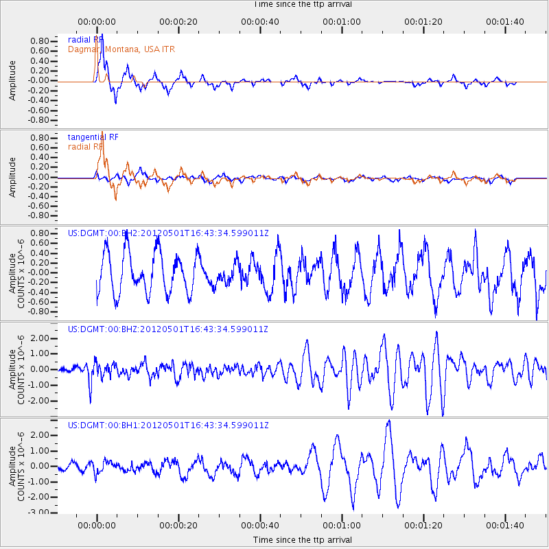
DGMT Dagmar, Montana, USA - Earthquake Result Viewer
*The percent match for this event was below the threshold and hence no stack was calculated.
| Earthquake location: |
Guerrero, Mexico |
| Earthquake latitude/longitude: |
18.3/-101.1 |
| Earthquake time(UTC): |
2012/05/01 (122) 16:37:58 GMT |
| Earthquake Depth: |
51 km |
| Earthquake Magnitude: |
5.7 MW, 5.5 MB, 5.7 MW |
| Earthquake Catalog/Contributor: |
NEIC PDE/NEIC PDE-M |
|
| Network: |
US United States National Seismic Network |
| Station: |
DGMT Dagmar, Montana, USA |
| Lat/Lon: |
48.47 N/104.20 W |
| Elevation: |
0.0 m |
|
| Distance: |
30.2 deg |
| Az: |
355.89 deg |
| Baz: |
174.125 deg |
| Ray Param: |
$rayparam |
*The percent match for this event was below the threshold and hence was not used in the summary stack. |
|
| Radial Match: |
87.077156 % |
| Radial Bump: |
297 |
| Transverse Match: |
46.551964 % |
| Transverse Bump: |
347 |
| SOD ConfigId: |
558545 |
| Insert Time: |
2013-09-19 17:42:36.202 +0000 |
| GWidth: |
2.5 |
| Max Bumps: |
400 |
| Tol: |
0.001 |
|
Signal To Noise
| Channel | StoN | STA | LTA |
| US:DGMT:00:BHZ:20120501T16:43:34.599011Z | 2.4246392 | 3.9297677E-7 | 1.6207639E-7 |
| US:DGMT:00:BH1:20120501T16:43:34.599011Z | 1.0482739 | 3.8103926E-7 | 3.6349206E-7 |
| US:DGMT:00:BH2:20120501T16:43:34.599011Z | 0.49303463 | 2.0077928E-7 | 4.0723157E-7 |
| Arrivals |
| Ps | |
| PpPs | |
| PsPs/PpSs | |


