You are here: Home > Network List > UW - Pacific Northwest Regional Seismic Network Stations List
> Station FISH Seaside, OR, USA > Earthquake Result Viewer
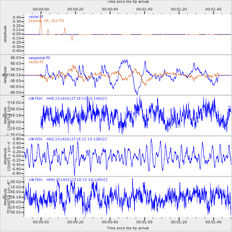
FISH Seaside, OR, USA - Earthquake Result Viewer
*The percent match for this event was below the threshold and hence no stack was calculated.
| Earthquake location: |
Tonga Islands |
| Earthquake latitude/longitude: |
-17.8/-173.2 |
| Earthquake time(UTC): |
2014/09/13 (256) 18:22:14 GMT |
| Earthquake Depth: |
12 km |
| Earthquake Magnitude: |
5.3 MW |
| Earthquake Catalog/Contributor: |
ISC/ISC |
|
| Network: |
UW Pacific Northwest Regional Seismic Network |
| Station: |
FISH Seaside, OR, USA |
| Lat/Lon: |
45.93 N/123.56 W |
| Elevation: |
325 m |
|
| Distance: |
77.7 deg |
| Az: |
32.968 deg |
| Baz: |
227.968 deg |
| Ray Param: |
$rayparam |
*The percent match for this event was below the threshold and hence was not used in the summary stack. |
|
| Radial Match: |
41.22335 % |
| Radial Bump: |
400 |
| Transverse Match: |
38.25517 % |
| Transverse Bump: |
400 |
| SOD ConfigId: |
3390531 |
| Insert Time: |
2019-04-14 00:58:12.006 +0000 |
| GWidth: |
2.5 |
| Max Bumps: |
400 |
| Tol: |
0.001 |
|
Signal To Noise
| Channel | StoN | STA | LTA |
| UW:FISH: :HHZ:20140913T18:33:39.19802Z | 0.9425348 | 2.568846E-7 | 2.7254654E-7 |
| UW:FISH: :HHN:20140913T18:33:39.19802Z | 0.8932526 | 4.8791637E-9 | 5.462244E-9 |
| UW:FISH: :HHE:20140913T18:33:39.19802Z | 1.1749778 | 4.6662723E-9 | 3.971371E-9 |
| Arrivals |
| Ps | |
| PpPs | |
| PsPs/PpSs | |


