PKME Peaks-Kenny State Park, Maine, USA - Earthquake Result Viewer
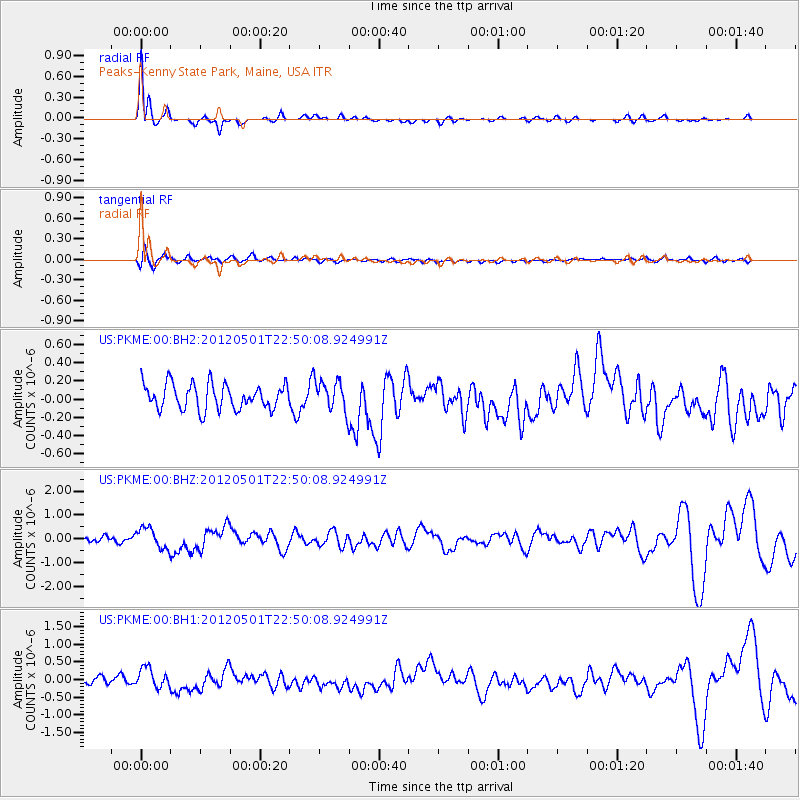
Earthquake location: Near Coast Of Chiapas, Mexico
Earthquake latitude/longitude: 14.4/-92.9
Earthquake time(UTC): 2012/05/01 (122) 22:43:33 GMT
Earthquake Depth: 14 km
Earthquake Magnitude: 5.6 MB, 5.8 MS, 6.0 MW, 5.9 MW
Earthquake Catalog/Contributor: WHDF/NEIC
Network: US United States National Seismic Network
Station: PKME Peaks-Kenny State Park, Maine, USA
Lat/Lon: 45.26 N/69.29 W
Elevation: 108 m
Distance: 36.7 deg
Az: 28.244 deg
Baz: 220.494 deg
Ray Param: 0.07652939
Estimated Moho Depth: 11.25 km
Estimated Crust Vp/Vs: 1.69
Assumed Crust Vp: 6.419 km/s
Estimated Crust Vs: 3.81 km/s
Estimated Crust Poisson's Ratio: 0.23
Radial Match: 85.56482 %
Radial Bump: 307
Transverse Match: 62.431538 %
Transverse Bump: 400
SOD ConfigId: 558545
Insert Time: 2013-09-19 17:45:53.532 +0000
GWidth: 2.5
Max Bumps: 400
Tol: 0.001

Signal To Noise

ChannelStoNSTALTA
US:PKME:00:BHZ:20120501T22:50:08.924991Z2.16117674.3212938E-71.9995099E-7
US:PKME:00:BH1:20120501T22:50:08.924991Z2.41838572.9251186E-71.2095335E-7
US:PKME:00:BH2:20120501T22:50:08.924991Z1.22840731.6990019E-71.3830933E-7
Arrivals
Ps1.3 SECOND
PpPs4.4 SECOND
PsPs/PpSs5.6 SECOND