You are here: Home > Network List > CN - Canadian National Seismograph Network Stations List
> Station PMB Pemberton, British Columbia, Canada > Earthquake Result Viewer
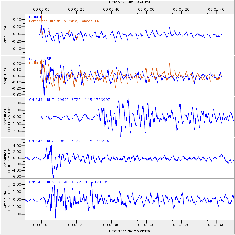
PMB Pemberton, British Columbia, Canada - Earthquake Result Viewer
*The percent match for this event was below the threshold and hence no stack was calculated.
| Earthquake location: |
Bonin Islands, Japan Region |
| Earthquake latitude/longitude: |
29.0/138.9 |
| Earthquake time(UTC): |
1996/03/16 (076) 22:04:06 GMT |
| Earthquake Depth: |
477 km |
| Earthquake Magnitude: |
5.9 MB, 6.6 UNKNOWN, 6.1 MB |
| Earthquake Catalog/Contributor: |
WHDF/NEIC |
|
| Network: |
CN Canadian National Seismograph Network |
| Station: |
PMB Pemberton, British Columbia, Canada |
| Lat/Lon: |
50.52 N/123.08 W |
| Elevation: |
400 m |
|
| Distance: |
72.9 deg |
| Az: |
41.399 deg |
| Baz: |
294.824 deg |
| Ray Param: |
$rayparam |
*The percent match for this event was below the threshold and hence was not used in the summary stack. |
|
| Radial Match: |
64.979706 % |
| Radial Bump: |
400 |
| Transverse Match: |
80.925 % |
| Transverse Bump: |
400 |
| SOD ConfigId: |
4480 |
| Insert Time: |
2010-02-27 06:55:49.717 +0000 |
| GWidth: |
2.5 |
| Max Bumps: |
400 |
| Tol: |
0.001 |
|
Signal To Noise
| Channel | StoN | STA | LTA |
| CN:PMB: :BHZ:19960316T22:14:15.173999Z | 4.5418096 | 1.4566856E-6 | 3.2072802E-7 |
| CN:PMB: :BHN:19960316T22:14:15.173999Z | 1.8658997 | 3.6926713E-7 | 1.97903E-7 |
| CN:PMB: :BHE:19960316T22:14:15.173999Z | 2.4347844 | 5.541105E-7 | 2.2758094E-7 |
| Arrivals |
| Ps | |
| PpPs | |
| PsPs/PpSs | |


