You are here: Home > Network List > IU - Global Seismograph Network (GSN - IRIS/USGS) Stations List
> Station RAR Rarotonga, Cook Islands > Earthquake Result Viewer
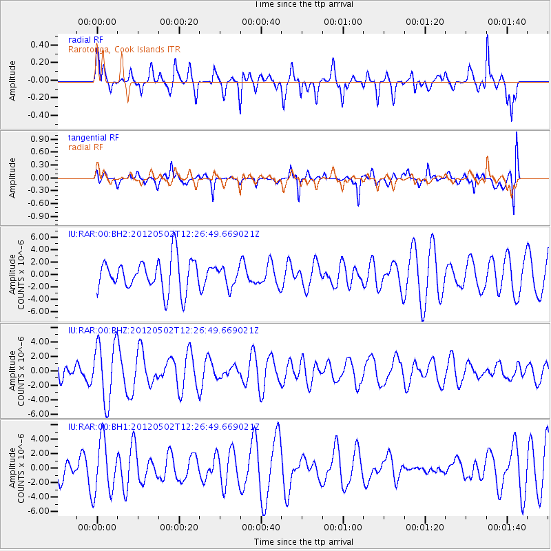
RAR Rarotonga, Cook Islands - Earthquake Result Viewer
*The percent match for this event was below the threshold and hence no stack was calculated.
| Earthquake location: |
West Of Macquarie Island |
| Earthquake latitude/longitude: |
-54.6/143.8 |
| Earthquake time(UTC): |
2012/05/02 (123) 12:17:59 GMT |
| Earthquake Depth: |
10 km |
| Earthquake Magnitude: |
5.5 MB, 5.5 MS, 5.8 MW, 5.7 MW |
| Earthquake Catalog/Contributor: |
WHDF/NEIC |
|
| Network: |
IU Global Seismograph Network (GSN - IRIS/USGS) |
| Station: |
RAR Rarotonga, Cook Islands |
| Lat/Lon: |
21.21 S/159.77 W |
| Elevation: |
28 m |
|
| Distance: |
53.6 deg |
| Az: |
74.852 deg |
| Baz: |
217.046 deg |
| Ray Param: |
$rayparam |
*The percent match for this event was below the threshold and hence was not used in the summary stack. |
|
| Radial Match: |
63.218796 % |
| Radial Bump: |
400 |
| Transverse Match: |
67.30424 % |
| Transverse Bump: |
400 |
| SOD ConfigId: |
558545 |
| Insert Time: |
2013-09-19 17:47:44.301 +0000 |
| GWidth: |
2.5 |
| Max Bumps: |
400 |
| Tol: |
0.001 |
|
Signal To Noise
| Channel | StoN | STA | LTA |
| IU:RAR:00:BHZ:20120502T12:26:49.669021Z | 2.5713475 | 4.1563703E-6 | 1.6164173E-6 |
| IU:RAR:00:BH1:20120502T12:26:49.669021Z | 2.5895827 | 3.6301267E-6 | 1.4018192E-6 |
| IU:RAR:00:BH2:20120502T12:26:49.669021Z | 0.6192815 | 1.6001733E-6 | 2.583919E-6 |
| Arrivals |
| Ps | |
| PpPs | |
| PsPs/PpSs | |


