You are here: Home > Network List > US - United States National Seismic Network Stations List
> Station EGMT Eagleton, Montana, USA > Earthquake Result Viewer
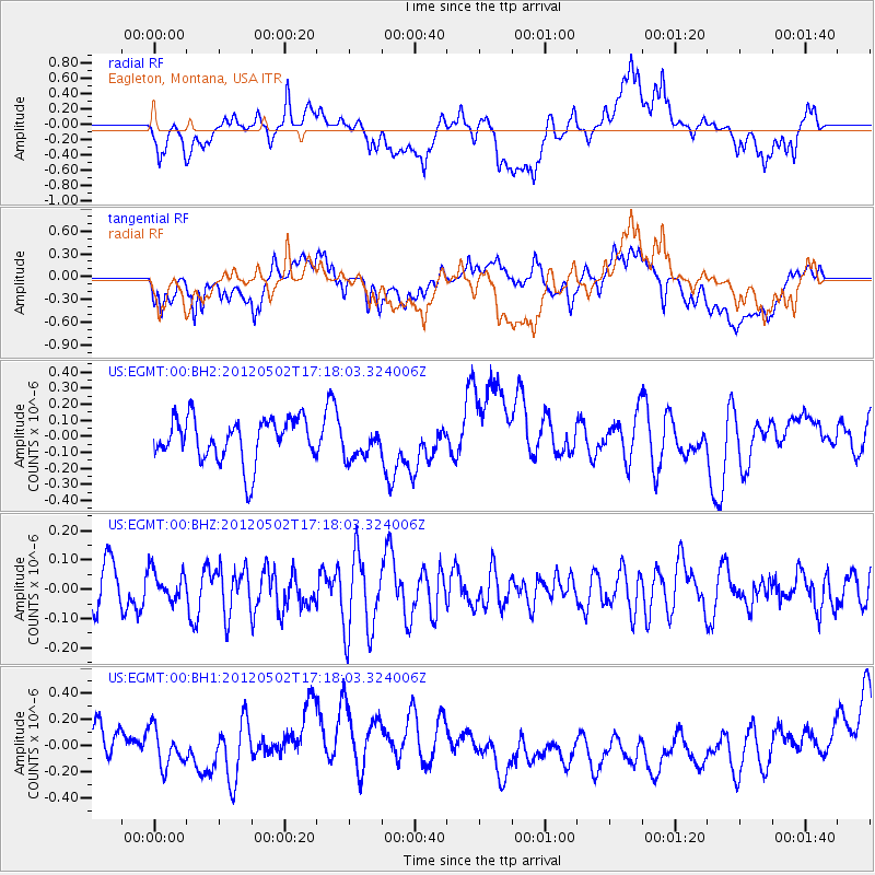
EGMT Eagleton, Montana, USA - Earthquake Result Viewer
*The percent match for this event was below the threshold and hence no stack was calculated.
| Earthquake location: |
Southeast Of Easter Island |
| Earthquake latitude/longitude: |
-35.9/-102.7 |
| Earthquake time(UTC): |
2012/05/02 (123) 17:06:05 GMT |
| Earthquake Depth: |
10 km |
| Earthquake Magnitude: |
5.5 MW, 4.9 MS, 4.7 MB |
| Earthquake Catalog/Contributor: |
WHDF/NEIC |
|
| Network: |
US United States National Seismic Network |
| Station: |
EGMT Eagleton, Montana, USA |
| Lat/Lon: |
48.02 N/109.75 W |
| Elevation: |
1055 m |
|
| Distance: |
83.8 deg |
| Az: |
355.261 deg |
| Baz: |
174.265 deg |
| Ray Param: |
$rayparam |
*The percent match for this event was below the threshold and hence was not used in the summary stack. |
|
| Radial Match: |
44.8207 % |
| Radial Bump: |
400 |
| Transverse Match: |
39.21376 % |
| Transverse Bump: |
400 |
| SOD ConfigId: |
558545 |
| Insert Time: |
2013-09-19 17:51:10.797 +0000 |
| GWidth: |
2.5 |
| Max Bumps: |
400 |
| Tol: |
0.001 |
|
Signal To Noise
| Channel | StoN | STA | LTA |
| US:EGMT:00:BHZ:20120502T17:18:03.324006Z | 0.7233025 | 4.9922505E-8 | 6.9020224E-8 |
| US:EGMT:00:BH1:20120502T17:18:03.324006Z | 0.7763256 | 1.6835037E-7 | 2.1685537E-7 |
| US:EGMT:00:BH2:20120502T17:18:03.324006Z | 0.7471582 | 1.0018847E-7 | 1.3409272E-7 |
| Arrivals |
| Ps | |
| PpPs | |
| PsPs/PpSs | |


