You are here: Home > Network List > US - United States National Seismic Network Stations List
> Station ERPA Erie, Pennsylvania, USA > Earthquake Result Viewer
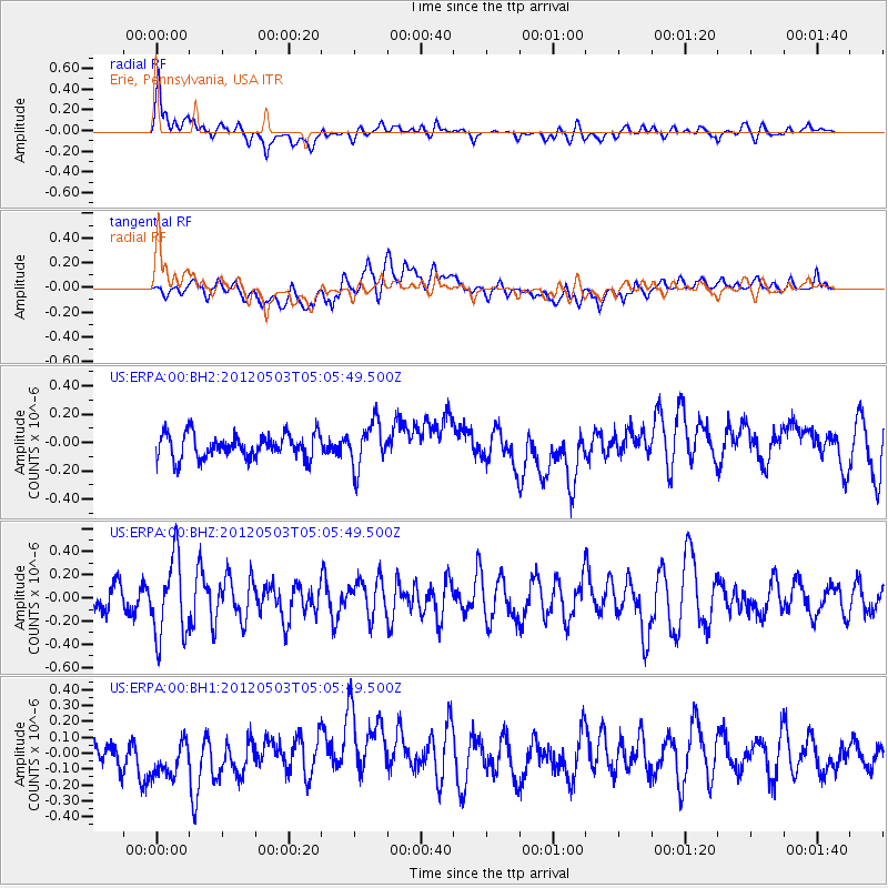
ERPA Erie, Pennsylvania, USA - Earthquake Result Viewer
*The percent match for this event was below the threshold and hence no stack was calculated.
| Earthquake location: |
Revilla Gigedo Islands Region |
| Earthquake latitude/longitude: |
21.2/-108.8 |
| Earthquake time(UTC): |
2012/05/03 (124) 04:59:54 GMT |
| Earthquake Depth: |
10 km |
| Earthquake Magnitude: |
5.6 MW |
| Earthquake Catalog/Contributor: |
NEIC PDE/NEIC PDE-M |
|
| Network: |
US United States National Seismic Network |
| Station: |
ERPA Erie, Pennsylvania, USA |
| Lat/Lon: |
42.12 N/79.99 W |
| Elevation: |
306 m |
|
| Distance: |
31.9 deg |
| Az: |
42.654 deg |
| Baz: |
238.185 deg |
| Ray Param: |
$rayparam |
*The percent match for this event was below the threshold and hence was not used in the summary stack. |
|
| Radial Match: |
67.11858 % |
| Radial Bump: |
400 |
| Transverse Match: |
47.00317 % |
| Transverse Bump: |
400 |
| SOD ConfigId: |
558545 |
| Insert Time: |
2013-09-19 17:54:27.565 +0000 |
| GWidth: |
2.5 |
| Max Bumps: |
400 |
| Tol: |
0.001 |
|
Signal To Noise
| Channel | StoN | STA | LTA |
| US:ERPA:00:BHZ:20120503T05:05:49.500Z | 2.8713872 | 3.4339175E-7 | 1.1959088E-7 |
| US:ERPA:00:BH1:20120503T05:05:49.500Z | 1.0979892 | 1.372715E-7 | 1.250208E-7 |
| US:ERPA:00:BH2:20120503T05:05:49.500Z | 1.8787014 | 1.6102844E-7 | 8.571263E-8 |
| Arrivals |
| Ps | |
| PpPs | |
| PsPs/PpSs | |


