You are here: Home > Network List > CN - Canadian National Seismograph Network Stations List
> Station PMB Pemberton, British Columbia, Canada > Earthquake Result Viewer
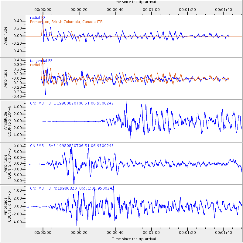
PMB Pemberton, British Columbia, Canada - Earthquake Result Viewer
*The percent match for this event was below the threshold and hence no stack was calculated.
| Earthquake location: |
Bonin Islands, Japan Region |
| Earthquake latitude/longitude: |
28.9/139.3 |
| Earthquake time(UTC): |
1998/08/20 (232) 06:40:55 GMT |
| Earthquake Depth: |
441 km |
| Earthquake Magnitude: |
6.1 MB, 7.0 UNKNOWN, 7.0 MW |
| Earthquake Catalog/Contributor: |
WHDF/NEIC |
|
| Network: |
CN Canadian National Seismograph Network |
| Station: |
PMB Pemberton, British Columbia, Canada |
| Lat/Lon: |
50.52 N/123.08 W |
| Elevation: |
400 m |
|
| Distance: |
72.8 deg |
| Az: |
41.496 deg |
| Baz: |
294.524 deg |
| Ray Param: |
$rayparam |
*The percent match for this event was below the threshold and hence was not used in the summary stack. |
|
| Radial Match: |
69.804375 % |
| Radial Bump: |
400 |
| Transverse Match: |
89.96873 % |
| Transverse Bump: |
400 |
| SOD ConfigId: |
4480 |
| Insert Time: |
2010-02-27 06:56:01.463 +0000 |
| GWidth: |
2.5 |
| Max Bumps: |
400 |
| Tol: |
0.001 |
|
Signal To Noise
| Channel | StoN | STA | LTA |
| CN:PMB: :BHZ:19980820T06:51:06.950024Z | 4.59421 | 3.9019721E-7 | 8.493238E-8 |
| CN:PMB: :BHN:19980820T06:51:06.950024Z | 2.136964 | 1.05350004E-7 | 4.9298908E-8 |
| CN:PMB: :BHE:19980820T06:51:06.950024Z | 2.5803294 | 1.4067619E-7 | 5.4518697E-8 |
| Arrivals |
| Ps | |
| PpPs | |
| PsPs/PpSs | |


