You are here: Home > Network List > IU - Global Seismograph Network (GSN - IRIS/USGS) Stations List
> Station MAJO Matsushiro, Japan > Earthquake Result Viewer
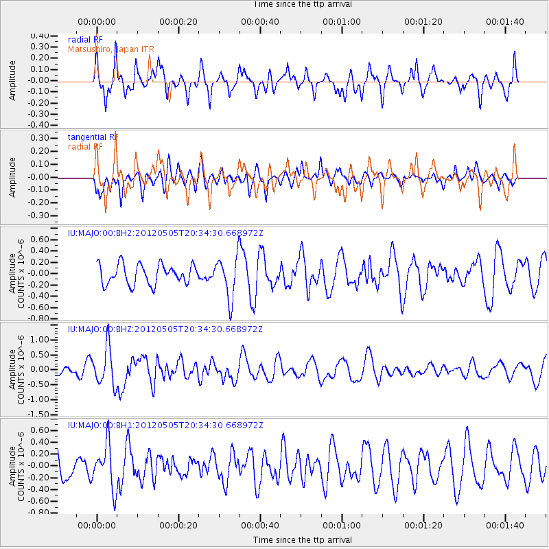
MAJO Matsushiro, Japan - Earthquake Result Viewer
*The percent match for this event was below the threshold and hence no stack was calculated.
| Earthquake location: |
Tonga Islands |
| Earthquake latitude/longitude: |
-21.5/-174.2 |
| Earthquake time(UTC): |
2012/05/05 (126) 20:23:31 GMT |
| Earthquake Depth: |
8.5 km |
| Earthquake Magnitude: |
5.6 MS, 5.7 MW, 5.6 MW |
| Earthquake Catalog/Contributor: |
WHDF/NEIC |
|
| Network: |
IU Global Seismograph Network (GSN - IRIS/USGS) |
| Station: |
MAJO Matsushiro, Japan |
| Lat/Lon: |
36.55 N/138.20 E |
| Elevation: |
405 m |
|
| Distance: |
73.1 deg |
| Az: |
321.602 deg |
| Baz: |
134.079 deg |
| Ray Param: |
$rayparam |
*The percent match for this event was below the threshold and hence was not used in the summary stack. |
|
| Radial Match: |
77.570366 % |
| Radial Bump: |
400 |
| Transverse Match: |
51.379368 % |
| Transverse Bump: |
400 |
| SOD ConfigId: |
558545 |
| Insert Time: |
2013-09-19 17:59:44.197 +0000 |
| GWidth: |
2.5 |
| Max Bumps: |
400 |
| Tol: |
0.001 |
|
Signal To Noise
| Channel | StoN | STA | LTA |
| IU:MAJO:00:BHZ:20120505T20:34:30.668972Z | 3.2746527 | 6.537764E-7 | 1.9964754E-7 |
| IU:MAJO:00:BH1:20120505T20:34:30.668972Z | 1.6189162 | 3.8704715E-7 | 2.3907793E-7 |
| IU:MAJO:00:BH2:20120505T20:34:30.668972Z | 2.226499 | 3.9051375E-7 | 1.7539364E-7 |
| Arrivals |
| Ps | |
| PpPs | |
| PsPs/PpSs | |


