You are here: Home > Network List > US - United States National Seismic Network Stations List
> Station MSO Missoula, Montana, USA > Earthquake Result Viewer
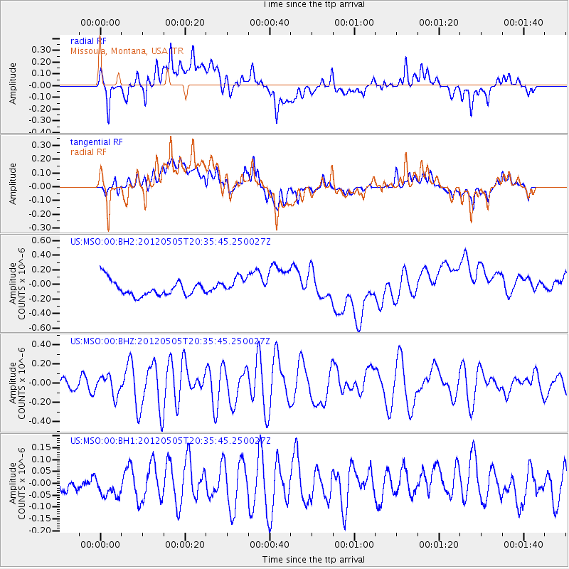
MSO Missoula, Montana, USA - Earthquake Result Viewer
*The percent match for this event was below the threshold and hence no stack was calculated.
| Earthquake location: |
Tonga Islands |
| Earthquake latitude/longitude: |
-21.5/-174.2 |
| Earthquake time(UTC): |
2012/05/05 (126) 20:23:31 GMT |
| Earthquake Depth: |
8.5 km |
| Earthquake Magnitude: |
5.6 MS, 5.7 MW, 5.6 MW |
| Earthquake Catalog/Contributor: |
WHDF/NEIC |
|
| Network: |
US United States National Seismic Network |
| Station: |
MSO Missoula, Montana, USA |
| Lat/Lon: |
46.83 N/113.94 W |
| Elevation: |
1264 m |
|
| Distance: |
87.0 deg |
| Az: |
36.666 deg |
| Baz: |
234.1 deg |
| Ray Param: |
$rayparam |
*The percent match for this event was below the threshold and hence was not used in the summary stack. |
|
| Radial Match: |
32.184387 % |
| Radial Bump: |
400 |
| Transverse Match: |
27.813862 % |
| Transverse Bump: |
400 |
| SOD ConfigId: |
558545 |
| Insert Time: |
2013-09-19 18:00:57.877 +0000 |
| GWidth: |
2.5 |
| Max Bumps: |
400 |
| Tol: |
0.001 |
|
Signal To Noise
| Channel | StoN | STA | LTA |
| US:MSO:00:BHZ:20120505T20:35:45.250027Z | 2.060156 | 1.02000335E-7 | 4.9510973E-8 |
| US:MSO:00:BH1:20120505T20:35:45.250027Z | 1.1127944 | 4.3380464E-8 | 3.8983362E-8 |
| US:MSO:00:BH2:20120505T20:35:45.250027Z | 1.2256125 | 1.2746332E-7 | 1.0399969E-7 |
| Arrivals |
| Ps | |
| PpPs | |
| PsPs/PpSs | |


