You are here: Home > Network List > CN - Canadian National Seismograph Network Stations List
> Station PMB Pemberton, British Columbia, Canada > Earthquake Result Viewer
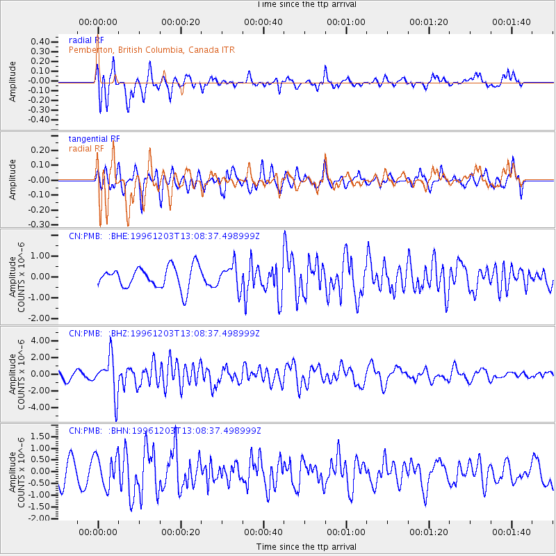
PMB Pemberton, British Columbia, Canada - Earthquake Result Viewer
*The percent match for this event was below the threshold and hence no stack was calculated.
| Earthquake location: |
Tonga Islands Region |
| Earthquake latitude/longitude: |
-18.4/-172.3 |
| Earthquake time(UTC): |
1996/12/03 (338) 12:56:56 GMT |
| Earthquake Depth: |
33 km |
| Earthquake Magnitude: |
6.0 MB, 6.0 MS, 6.1 UNKNOWN, 6.1 MW |
| Earthquake Catalog/Contributor: |
WHDF/NEIC |
|
| Network: |
CN Canadian National Seismograph Network |
| Station: |
PMB Pemberton, British Columbia, Canada |
| Lat/Lon: |
50.52 N/123.08 W |
| Elevation: |
400 m |
|
| Distance: |
81.1 deg |
| Az: |
29.286 deg |
| Baz: |
226.701 deg |
| Ray Param: |
$rayparam |
*The percent match for this event was below the threshold and hence was not used in the summary stack. |
|
| Radial Match: |
74.008224 % |
| Radial Bump: |
386 |
| Transverse Match: |
56.28837 % |
| Transverse Bump: |
400 |
| SOD ConfigId: |
4480 |
| Insert Time: |
2010-02-27 06:56:14.984 +0000 |
| GWidth: |
2.5 |
| Max Bumps: |
400 |
| Tol: |
0.001 |
|
Signal To Noise
| Channel | StoN | STA | LTA |
| CN:PMB: :BHZ:19961203T13:08:37.498999Z | 4.0748706 | 2.389532E-6 | 5.864068E-7 |
| CN:PMB: :BHN:19961203T13:08:37.498999Z | 1.5360045 | 6.673554E-7 | 4.3447488E-7 |
| CN:PMB: :BHE:19961203T13:08:37.498999Z | 1.1514529 | 5.895268E-7 | 5.119852E-7 |
| Arrivals |
| Ps | |
| PpPs | |
| PsPs/PpSs | |


