You are here: Home > Network List > IU - Global Seismograph Network (GSN - IRIS/USGS) Stations List
> Station RSSD Black Hills, South Dakota, USA > Earthquake Result Viewer
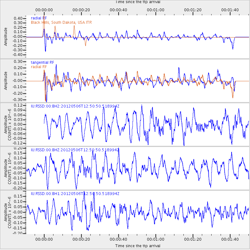
RSSD Black Hills, South Dakota, USA - Earthquake Result Viewer
*The percent match for this event was below the threshold and hence no stack was calculated.
| Earthquake location: |
Central Peru |
| Earthquake latitude/longitude: |
-13.8/-75.8 |
| Earthquake time(UTC): |
2012/05/06 (127) 12:40:59 GMT |
| Earthquake Depth: |
54 km |
| Earthquake Magnitude: |
5.6 MW, 5.5 ML |
| Earthquake Catalog/Contributor: |
NEIC PDE/NEIC PDE-M |
|
| Network: |
IU Global Seismograph Network (GSN - IRIS/USGS) |
| Station: |
RSSD Black Hills, South Dakota, USA |
| Lat/Lon: |
44.12 N/104.04 W |
| Elevation: |
2090 m |
|
| Distance: |
63.1 deg |
| Az: |
337.549 deg |
| Baz: |
148.995 deg |
| Ray Param: |
$rayparam |
*The percent match for this event was below the threshold and hence was not used in the summary stack. |
|
| Radial Match: |
47.99387 % |
| Radial Bump: |
400 |
| Transverse Match: |
54.87928 % |
| Transverse Bump: |
400 |
| SOD ConfigId: |
558545 |
| Insert Time: |
2013-09-19 18:03:47.534 +0000 |
| GWidth: |
2.5 |
| Max Bumps: |
400 |
| Tol: |
0.001 |
|
Signal To Noise
| Channel | StoN | STA | LTA |
| IU:RSSD:00:BHZ:20120506T12:50:50.518994Z | 2.6899748 | 1.0250209E-7 | 3.8105224E-8 |
| IU:RSSD:00:BH1:20120506T12:50:50.518994Z | 1.5817297 | 6.03102E-8 | 3.8129272E-8 |
| IU:RSSD:00:BH2:20120506T12:50:50.518994Z | 1.2819933 | 6.105129E-8 | 4.762216E-8 |
| Arrivals |
| Ps | |
| PpPs | |
| PsPs/PpSs | |


