You are here: Home > Network List > US - United States National Seismic Network Stations List
> Station MSO Missoula, Montana, USA > Earthquake Result Viewer
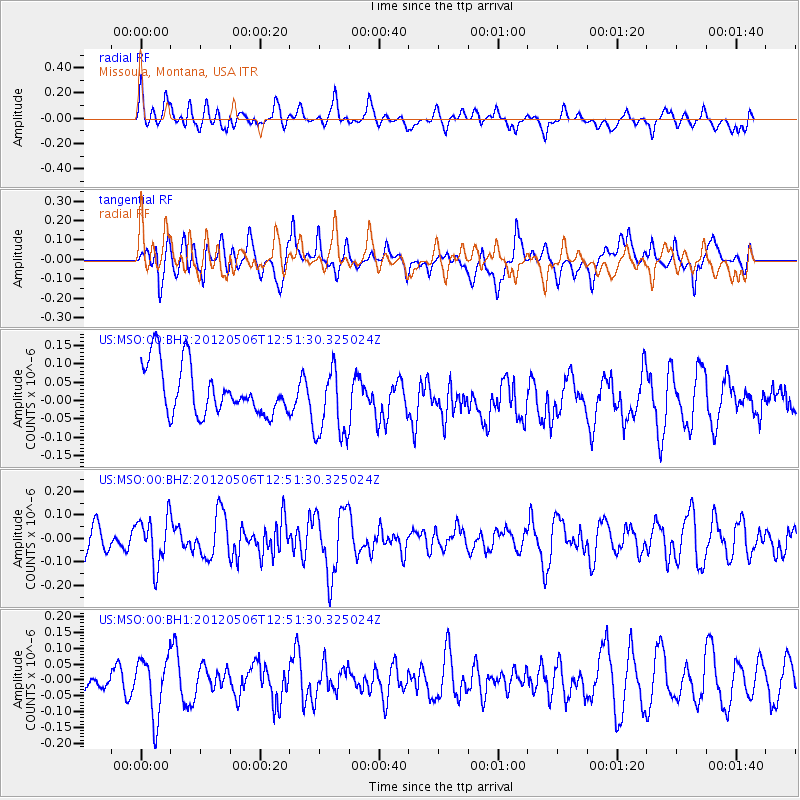
MSO Missoula, Montana, USA - Earthquake Result Viewer
*The percent match for this event was below the threshold and hence no stack was calculated.
| Earthquake location: |
Central Peru |
| Earthquake latitude/longitude: |
-13.8/-75.8 |
| Earthquake time(UTC): |
2012/05/06 (127) 12:40:59 GMT |
| Earthquake Depth: |
54 km |
| Earthquake Magnitude: |
5.6 MW, 5.5 ML |
| Earthquake Catalog/Contributor: |
NEIC PDE/NEIC PDE-M |
|
| Network: |
US United States National Seismic Network |
| Station: |
MSO Missoula, Montana, USA |
| Lat/Lon: |
46.83 N/113.94 W |
| Elevation: |
1264 m |
|
| Distance: |
69.4 deg |
| Az: |
333.061 deg |
| Baz: |
140.137 deg |
| Ray Param: |
$rayparam |
*The percent match for this event was below the threshold and hence was not used in the summary stack. |
|
| Radial Match: |
46.338024 % |
| Radial Bump: |
400 |
| Transverse Match: |
53.068737 % |
| Transverse Bump: |
400 |
| SOD ConfigId: |
558545 |
| Insert Time: |
2013-09-19 18:05:05.491 +0000 |
| GWidth: |
2.5 |
| Max Bumps: |
400 |
| Tol: |
0.001 |
|
Signal To Noise
| Channel | StoN | STA | LTA |
| US:MSO:00:BHZ:20120506T12:51:30.325024Z | 2.1277218 | 1.0173462E-7 | 4.7813874E-8 |
| US:MSO:00:BH1:20120506T12:51:30.325024Z | 2.127761 | 9.350813E-8 | 4.3946727E-8 |
| US:MSO:00:BH2:20120506T12:51:30.325024Z | 1.5064847 | 1.0075127E-7 | 6.687839E-8 |
| Arrivals |
| Ps | |
| PpPs | |
| PsPs/PpSs | |


