You are here: Home > Network List > US - United States National Seismic Network Stations List
> Station HAWA Hanford, Washington, USA > Earthquake Result Viewer
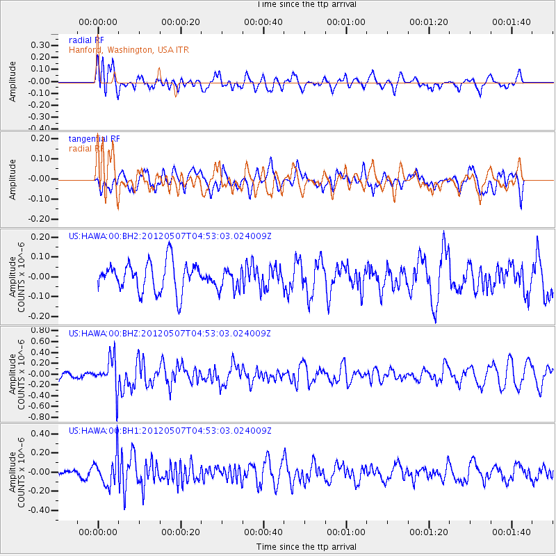
HAWA Hanford, Washington, USA - Earthquake Result Viewer
*The percent match for this event was below the threshold and hence no stack was calculated.
| Earthquake location: |
Eastern Caucasus |
| Earthquake latitude/longitude: |
41.5/46.8 |
| Earthquake time(UTC): |
2012/05/07 (128) 04:40:27 GMT |
| Earthquake Depth: |
11 km |
| Earthquake Magnitude: |
5.7 MB, 5.7 MS, 5.6 MW, 5.6 MW |
| Earthquake Catalog/Contributor: |
WHDF/NEIC |
|
| Network: |
US United States National Seismic Network |
| Station: |
HAWA Hanford, Washington, USA |
| Lat/Lon: |
46.39 N/119.53 W |
| Elevation: |
364 m |
|
| Distance: |
91.6 deg |
| Az: |
350.576 deg |
| Baz: |
10.228 deg |
| Ray Param: |
$rayparam |
*The percent match for this event was below the threshold and hence was not used in the summary stack. |
|
| Radial Match: |
57.159985 % |
| Radial Bump: |
400 |
| Transverse Match: |
59.15397 % |
| Transverse Bump: |
400 |
| SOD ConfigId: |
558545 |
| Insert Time: |
2013-09-19 18:09:11.182 +0000 |
| GWidth: |
2.5 |
| Max Bumps: |
400 |
| Tol: |
0.001 |
|
Signal To Noise
| Channel | StoN | STA | LTA |
| US:HAWA:00:BHZ:20120507T04:53:03.024009Z | 3.0889606 | 3.0647186E-7 | 9.921521E-8 |
| US:HAWA:00:BH1:20120507T04:53:03.024009Z | 2.6087606 | 1.5943938E-7 | 6.111691E-8 |
| US:HAWA:00:BH2:20120507T04:53:03.024009Z | 0.751012 | 5.561737E-8 | 7.4056565E-8 |
| Arrivals |
| Ps | |
| PpPs | |
| PsPs/PpSs | |


