You are here: Home > Network List > US - United States National Seismic Network Stations List
> Station DGMT Dagmar, Montana, USA > Earthquake Result Viewer
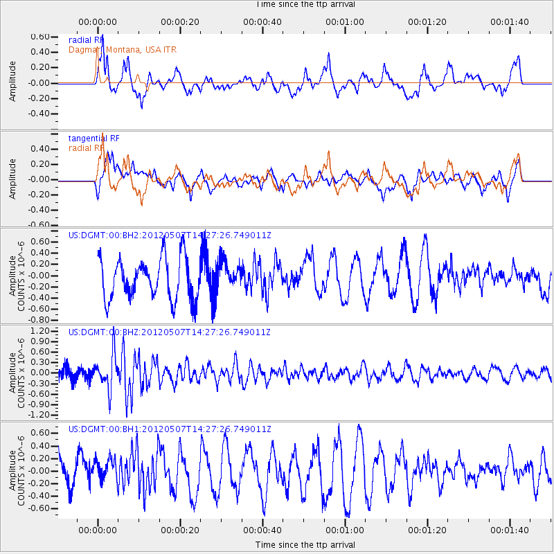
DGMT Dagmar, Montana, USA - Earthquake Result Viewer
*The percent match for this event was below the threshold and hence no stack was calculated.
| Earthquake location: |
Eastern Caucasus |
| Earthquake latitude/longitude: |
41.6/46.7 |
| Earthquake time(UTC): |
2012/05/07 (128) 14:15:14 GMT |
| Earthquake Depth: |
12 km |
| Earthquake Magnitude: |
5.6 MB, 5.0 MS, 5.3 MW, 5.4 MW |
| Earthquake Catalog/Contributor: |
WHDF/NEIC |
|
| Network: |
US United States National Seismic Network |
| Station: |
DGMT Dagmar, Montana, USA |
| Lat/Lon: |
48.47 N/104.20 W |
| Elevation: |
0.0 m |
|
| Distance: |
86.7 deg |
| Az: |
341.093 deg |
| Baz: |
21.435 deg |
| Ray Param: |
$rayparam |
*The percent match for this event was below the threshold and hence was not used in the summary stack. |
|
| Radial Match: |
62.054955 % |
| Radial Bump: |
400 |
| Transverse Match: |
51.399105 % |
| Transverse Bump: |
400 |
| SOD ConfigId: |
558545 |
| Insert Time: |
2013-09-19 18:12:45.628 +0000 |
| GWidth: |
2.5 |
| Max Bumps: |
400 |
| Tol: |
0.001 |
|
Signal To Noise
| Channel | StoN | STA | LTA |
| US:DGMT:00:BHZ:20120507T14:27:26.749011Z | 4.014868 | 4.972929E-7 | 1.2386283E-7 |
| US:DGMT:00:BH1:20120507T14:27:26.749011Z | 0.67773575 | 2.034686E-7 | 3.002182E-7 |
| US:DGMT:00:BH2:20120507T14:27:26.749011Z | 0.68878746 | 2.510317E-7 | 3.6445454E-7 |
| Arrivals |
| Ps | |
| PpPs | |
| PsPs/PpSs | |


