You are here: Home > Network List > US - United States National Seismic Network Stations List
> Station MNTX Cornudas Mountains, Texas, USA > Earthquake Result Viewer
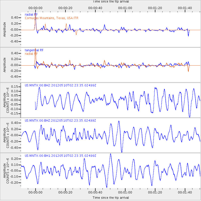
MNTX Cornudas Mountains, Texas, USA - Earthquake Result Viewer
*The percent match for this event was below the threshold and hence no stack was calculated.
| Earthquake location: |
Easter Island Region |
| Earthquake latitude/longitude: |
-28.7/-112.6 |
| Earthquake time(UTC): |
2012/05/10 (131) 02:13:56 GMT |
| Earthquake Depth: |
10 km |
| Earthquake Magnitude: |
5.8 MS, 5.3 MB, 5.9 MW, 5.8 MW |
| Earthquake Catalog/Contributor: |
WHDF/NEIC |
|
| Network: |
US United States National Seismic Network |
| Station: |
MNTX Cornudas Mountains, Texas, USA |
| Lat/Lon: |
31.70 N/105.38 W |
| Elevation: |
404 m |
|
| Distance: |
60.5 deg |
| Az: |
7.057 deg |
| Baz: |
187.272 deg |
| Ray Param: |
$rayparam |
*The percent match for this event was below the threshold and hence was not used in the summary stack. |
|
| Radial Match: |
76.37339 % |
| Radial Bump: |
290 |
| Transverse Match: |
59.77807 % |
| Transverse Bump: |
400 |
| SOD ConfigId: |
558545 |
| Insert Time: |
2013-09-19 18:21:40.830 +0000 |
| GWidth: |
2.5 |
| Max Bumps: |
400 |
| Tol: |
0.001 |
|
Signal To Noise
| Channel | StoN | STA | LTA |
| US:MNTX:00:BHZ:20120510T02:23:35.02499Z | 2.6188023 | 2.447547E-7 | 9.346054E-8 |
| US:MNTX:00:BH1:20120510T02:23:35.02499Z | 1.7752438 | 1.153383E-7 | 6.49704E-8 |
| US:MNTX:00:BH2:20120510T02:23:35.02499Z | 1.136942 | 7.0716865E-8 | 6.2199184E-8 |
| Arrivals |
| Ps | |
| PpPs | |
| PsPs/PpSs | |


