You are here: Home > Network List > IU - Global Seismograph Network (GSN - IRIS/USGS) Stations List
> Station MAJO Matsushiro, Japan > Earthquake Result Viewer
MAJO Matsushiro, Japan - Earthquake Result Viewer
*The percent match for this event was below the threshold and hence no stack was calculated.
| Earthquake location: |
Afghanistan-Tajikistan Bord Reg. |
| Earthquake latitude/longitude: |
38.6/70.4 |
| Earthquake time(UTC): |
2012/05/12 (133) 23:28:43 GMT |
| Earthquake Depth: |
10 km |
| Earthquake Magnitude: |
6.0 MB, 5.7 MS, 5.7 MW, 5.9 MW |
| Earthquake Catalog/Contributor: |
WHDF/NEIC |
|
| Network: |
IU Global Seismograph Network (GSN - IRIS/USGS) |
| Station: |
MAJO Matsushiro, Japan |
| Lat/Lon: |
36.55 N/138.20 E |
| Elevation: |
405 m |
|
| Distance: |
52.7 deg |
| Az: |
69.708 deg |
| Baz: |
294.151 deg |
| Ray Param: |
$rayparam |
*The percent match for this event was below the threshold and hence was not used in the summary stack. |
|
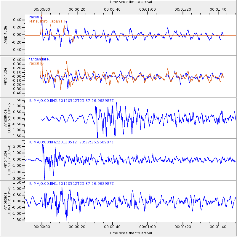
| Radial Match: |
67.38625 % |
| Radial Bump: |
400 |
| Transverse Match: |
60.76994 % |
| Transverse Bump: |
400 |
| SOD ConfigId: |
558545 |
| Insert Time: |
2013-09-19 18:24:21.741 +0000 |
| GWidth: |
2.5 |
| Max Bumps: |
400 |
| Tol: |
0.001 |
|
Signal To Noise
| Channel | StoN | STA | LTA |
| IU:MAJO:00:BHZ:20120512T23:37:26.968987Z | 7.051511 | 1.1474061E-6 | 1.6271777E-7 |
| IU:MAJO:00:BH1:20120512T23:37:26.968987Z | 1.7433043 | 3.1565645E-7 | 1.810679E-7 |
| IU:MAJO:00:BH2:20120512T23:37:26.968987Z | 3.5976465 | 6.5928083E-7 | 1.8325336E-7 |
| Arrivals |
| Ps | |
| PpPs | |
| PsPs/PpSs | |


