You are here: Home > Network List > US - United States National Seismic Network Stations List
> Station EGMT Eagleton, Montana, USA > Earthquake Result Viewer
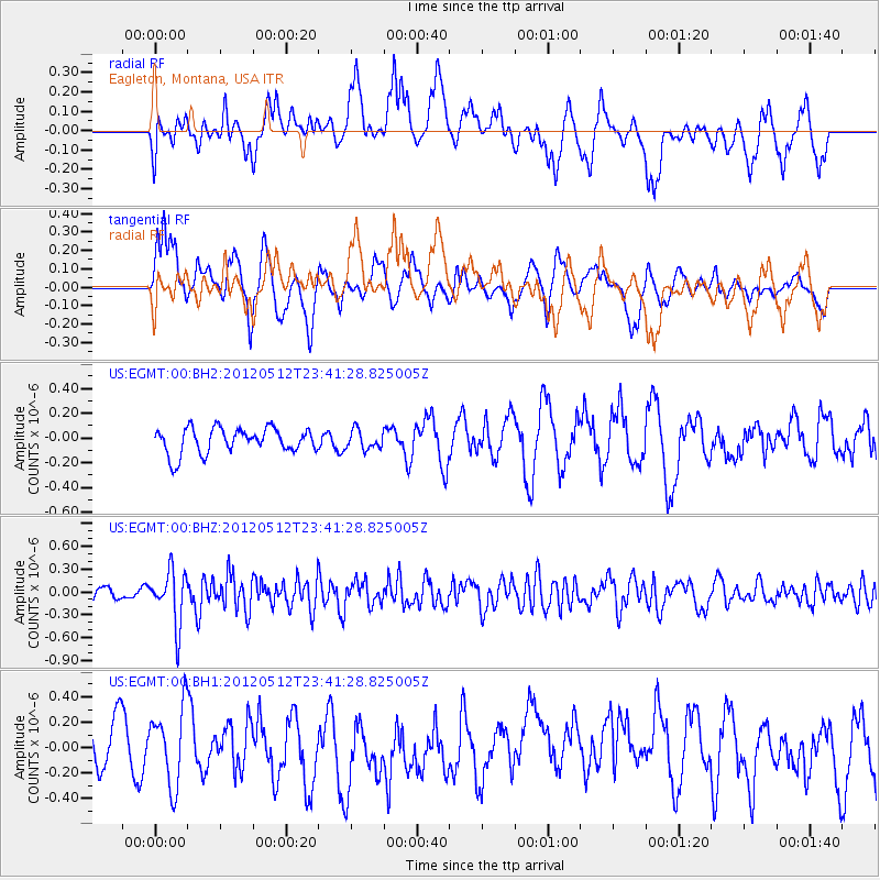
EGMT Eagleton, Montana, USA - Earthquake Result Viewer
*The percent match for this event was below the threshold and hence no stack was calculated.
| Earthquake location: |
Afghanistan-Tajikistan Bord Reg. |
| Earthquake latitude/longitude: |
38.6/70.4 |
| Earthquake time(UTC): |
2012/05/12 (133) 23:28:43 GMT |
| Earthquake Depth: |
10 km |
| Earthquake Magnitude: |
6.0 MB, 5.7 MS, 5.7 MW, 5.9 MW |
| Earthquake Catalog/Contributor: |
WHDF/NEIC |
|
| Network: |
US United States National Seismic Network |
| Station: |
EGMT Eagleton, Montana, USA |
| Lat/Lon: |
48.02 N/109.75 W |
| Elevation: |
1055 m |
|
| Distance: |
93.7 deg |
| Az: |
0.073 deg |
| Baz: |
359.915 deg |
| Ray Param: |
$rayparam |
*The percent match for this event was below the threshold and hence was not used in the summary stack. |
|
| Radial Match: |
50.072067 % |
| Radial Bump: |
400 |
| Transverse Match: |
59.060204 % |
| Transverse Bump: |
400 |
| SOD ConfigId: |
558545 |
| Insert Time: |
2013-09-19 18:24:58.753 +0000 |
| GWidth: |
2.5 |
| Max Bumps: |
400 |
| Tol: |
0.001 |
|
Signal To Noise
| Channel | StoN | STA | LTA |
| US:EGMT:00:BHZ:20120512T23:41:28.825005Z | 4.4887676 | 3.5052196E-7 | 7.808869E-8 |
| US:EGMT:00:BH1:20120512T23:41:28.825005Z | 1.954795 | 3.0481777E-7 | 1.5593338E-7 |
| US:EGMT:00:BH2:20120512T23:41:28.825005Z | 0.7403054 | 7.59875E-8 | 1.0264345E-7 |
| Arrivals |
| Ps | |
| PpPs | |
| PsPs/PpSs | |


